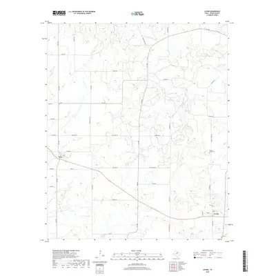
2019 Map of Loving
USGS Topo · Published 2019About this map
The community of Loving and the nearby settlement of Jean anchor this portion of Young County, where the landscape is defined by the headwaters of the Brazos River basin. Numerous watercourses, including Brushy Cr and Oak Cr, carve through the terrain, supporting the region's agricultural and ranching legacy. Local history is preserved in sites such as Hawkins Chapel Cem and the Loving Cem, which offer significant value for genealogical research. The road network, comprising routes like Garvey Ranch Rd and Flat Top Mtn Rd, illustrates how transportation follows the contours of the land, connecting family ranches and rural homesteads. Smaller features like Newman Lake provide evidence of local water management in this part of North Texas, while the presence of Farmer Rd points toward the early twentieth-century agricultural community that once defined the area north of the larger townships.
Find a feature on this map
43 named features on this map. Tap any name to fly to it.
Don’t see what you’re looking for? This feature index may not catch every label — zoom into the map to look around manually.
Map Details
Editions of this 2019 Loving Map
This is the sole edition of this map. No revisions or reprints were ever made.
Other maps of this area

1927 · Graham
USGS Topo · 1:62,500

1954 · Wichita Falls
USGS Topo · 1:250,000

1958 · Wichita Falls
USGS Topo · 1:250,000

1964 · Newcastle
USGS Topo · 1:24,000

1964 · Bobcat Bluff
USGS Topo · 1:24,000

1964 · Darnell Branch
USGS Topo · 1:24,000

1964 · True
USGS Topo · 1:24,000

1964 · Loving
USGS Topo · 1:24,000

1964 · Bryson
USGS Topo · 1:24,000

1964 · Lake Eddleman
USGS Topo · 1:24,000