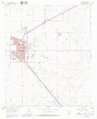
1962 Map of Lovington
USGS Topo · Published 1980About this map
Lovington serves as the bustling center of this 1962 survey, which was updated in 1979 to show significant urban expansion. The town is characterized by a concentrated grid of schools and public landmarks, including Lea Sch, Taylor Jr High Sch, and the County Fairground. The industrial character of Lea County is clearly visible in the surrounding High Plains terrain, where the Texas - New Mexico railroad line cuts southeast through the landscape, flanked by the Dean Oil Field and the East Lovington Oil Field.
Find a feature on this map
46 named features on this map. Tap any name to fly to it.
Don’t see what you’re looking for? This feature index may not catch every label — zoom into the map to look around manually.
Map Details
Editions of this 1962 Lovington Map
2 editions found
Other maps of this area

1954 · Hobbs
USGS Topo · 1:250,000

1954 · Brownfield
USGS Topo · 1:250,000

1958 · Brownfield
USGS Topo · 1:250,000

1958 · Hobbs
USGS Topo · 1:250,000

1962 · Brownfield
USGS Topo · 1:250,000

1962 · Lovington
USGS Topo · 1:24,000

1962 · Lovington
USGS Topo · 1:62,500

1969 · Humble City
USGS Topo · 1:24,000

1970 · Prairieview
USGS Topo · 1:24,000

1970 · Hillburn City
USGS Topo · 1:24,000