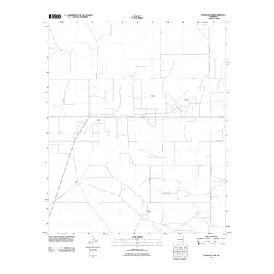
2010 Map of Lovington NW
USGS Topo · Published 2010About this map
Edson Ranch sits amid the expansive energy landscape of Lea County, where the infrastructure of the Permian Basin's petroleum industry is a defining characteristic. The map reveals the extensive spatial footprint of several major extraction areas, including the Townsend Oil Field in the north and the Eidson Oil Field and Shoe Bar Oil Field further south. This network of oil production is supported by a precise grid of rural roads and county thoroughfares, such as W Gum Ave and County Rd-119. Near the center of the quadrangle, the Lovington Airport at County Hwy-100A serves as a vital transportation node for this industrial and ranching region. The layout reflects the 21st-century evolution of New Mexico's plains, where traditional cattle operations coexist with modern aviation and significant mineral resource development.
Find a feature on this map
18 named features on this map. Tap any name to fly to it.
Don’t see what you’re looking for? This feature index may not catch every label — zoom into the map to look around manually.
Map Details
Editions of this 2010 Lovington NW Map
This is the sole edition of this map. No revisions or reprints were ever made.
Other maps of this area

1954 · Hobbs
USGS Topo · 1:250,000

1954 · Brownfield
USGS Topo · 1:250,000

1958 · Brownfield
USGS Topo · 1:250,000

1958 · Hobbs
USGS Topo · 1:250,000

1962 · Brownfield
USGS Topo · 1:250,000

1962 · Lovington
USGS Topo · 1:24,000

1962 · Lovington
USGS Topo · 1:62,500

1962 · Buckeye
USGS Topo · 1:62,500

1970 · Hillburn City
USGS Topo · 1:24,000

1970 · Hillburn City SW
USGS Topo · 1:24,000