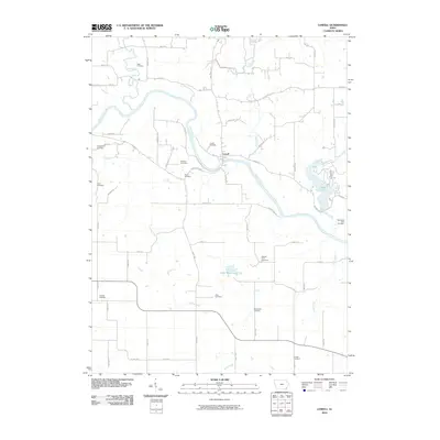
2010 Map of Lowell
USGS Topo · Published 2010About this map
The Skunk River meanders through this landscape, defining the character of the settlement at Lowell and its surrounding agricultural terrain. This area is notably dense with family and community burial grounds, providing a significant resource for genealogists researching names like Abbe Cemetery, Pickle Cemetery, and Bentler Farm Cemetery. The river's path is joined by several tributaries, including Big Creek and Mud Creek, while the eastern portion of the map is dominated by the waters of Geode Lake. The rural road network, including historic routes like Salem Rd and Agency Rd, connects these scattered settlements and farmsteads. Smaller water features like Lake Wilderness and the drainage of Hell Hollow punctuate the grid of section lines, reflecting a landscape where water management and traditional farming have long coexisted.
Find a feature on this map
61 named features on this map. Tap any name to fly to it.
Don’t see what you’re looking for? This feature index may not catch every label — zoom into the map to look around manually.
Map Details
Editions of this 2010 Lowell Map
This is the sole edition of this map. No revisions or reprints were ever made.
Other maps of this area

1936 · Fort Madison
USGS Topo · 1:62,500

1958 · Burlington
USGS Topo · 1:250,000

1961 · Burlington
USGS Topo · 1:250,000

1963 · Burlington
USGS Topo · 1:250,000

1964 · West Point
USGS Topo · 1:24,000
1964 · Fort Madison
USGS Topo · 1:24,000

1968 · Donnellson
USGS Topo · 1:24,000

1981 · Mount Pleasant
USGS Topo · 1:24,000
1981 · Danville
USGS Topo · 1:24,000
1981 · Lowell
USGS Topo · 1:24,000