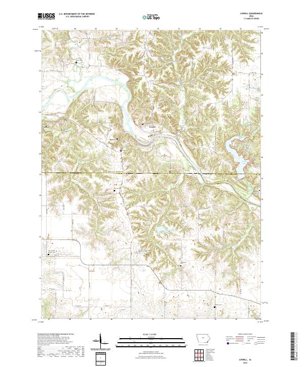
2022 Map of Lowell
USGS Topo · Published 2022About this map
Lowell sits at the heart of this landscape where the Skunk River carves a deep valley through the borderlands of Henry, Lee, and Des Moines counties. The map captures a rural Iowa interior defined by its many small burial grounds and pioneer landmarks. Genealogists will find notable sites such as the New Garden Quaker Cem and Woolens Corner Pioneer Cem in the southern reaches, alongside the Abbe Cem and Boyleston Cem further north. The topography transitions from the winding river bottoms to the managed waters of Geode Lake and Lake Wilderness. Interesting place names like Hell Hollow and the Emerson Plot hint at the local history of these rolling hills, while the intersection of roads like Co Hwy J20 and Salem Rd provide a clear view of the region's modern layout.
Find a feature on this map
53 named features on this map. Tap any name to fly to it.
Don’t see what you’re looking for? This feature index may not catch every label — zoom into the map to look around manually.
Map Details
Editions of this 2022 Lowell Map
This is the sole edition of this map. No revisions or reprints were ever made.
Other maps of this area

1936 · Fort Madison
USGS Topo · 1:62,500

1958 · Burlington
USGS Topo · 1:250,000

1961 · Burlington
USGS Topo · 1:250,000

1963 · Burlington
USGS Topo · 1:250,000

1964 · West Point
USGS Topo · 1:24,000
1964 · Fort Madison
USGS Topo · 1:24,000

1968 · Donnellson
USGS Topo · 1:24,000

1981 · Mount Pleasant
USGS Topo · 1:24,000
1981 · Danville
USGS Topo · 1:24,000
1981 · Lowell
USGS Topo · 1:24,000