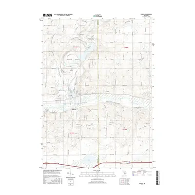
2017 Map of Lowell
USGS Topo · Published 2017About this map
The Grand River and Flat River converge at the heart of Lowell, a central hub in this modern survey of the Kent and Ionia county line. The landscape reflects a mix of aviation and recreation, with both the Lowell City Airport and the Van Strien Company Airport established near the river bends, while the Fred Meijer Flat River Valley Trail follows the corridor where rail lines once ran. The map preserves the names of several local settlements such as Fallassburg and Segwun, alongside smaller crossroad communities like South Boston. Local genealogists will find value in the documentation of numerous burial grounds, including the Oakwood, McBride, and Fallass cemeteries. From the waters of Pratt Lake in the south to the winding paths of Covered Bridge Road in the north, the map detail shows a territory shaped by its waterways and longstanding road networks.
Find a feature on this map
135 named features on this map. Tap any name to fly to it.
Don’t see what you’re looking for? This feature index may not catch every label — zoom into the map to look around manually.
Map Details
Editions of this 2017 Lowell Map
This is the sole edition of this map. No revisions or reprints were ever made.
Other maps of this area

1916 · Ionia
USGS Topo · 1:62,500

1918 · Ionia
USGS Topo · 1:62,500

1918 · Lowell
USGS Topo · 1:62,500

1943 · Ionia
USGS Topo · 1:62,500

1943 · Lowell
USGS Topo · 1:62,500

1954 · Midland
USGS Topo · 1:250,000

1958 · Midland
USGS Topo · 1:250,000

1958 · Grand Rapids
USGS Topo · 1:250,000

1959 · Midland
USGS Topo · 1:250,000

1961 · Grand Rapids
USGS Topo · 1:250,000
Featured Places
- Lowell Charter Township, MI
- Vergennes Township, MI
- Lowell, MI
- Keene Township, MI
- Segwun, Lowell Charter Township