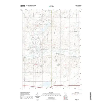
2019 Map of Lowell
USGS Topo · Published 2019About this map
The confluence of the Flat River and the Grand River anchors this Kent County landscape, where the settlement of Lowell serves as a central hub. Just north, the hamlet of Fallasburg remains a focal point for local history, situated near Fallas Cem and the iconic Covered Bridge Rd NE. The terrain transitions from the developed corridors along Fulton St E to the more open Hill Country and Hatch Hollow to the south. Genealogists will find a high concentration of burial sites, including Foxes Corners Cem, Saint Mary Cem, and Oakwood Cem near the town center, as well as McBride Cem and South Boston Cem further afield. Regional connectivity is evidenced by the N Country National Scenic Trail winding through the river valleys, alongside recreational infrastructure like the Fred Meijer Flat River Valley Trail and local aviation at the Lowell City Airport.
Find a feature on this map
85 named features on this map. Tap any name to fly to it.
Don’t see what you’re looking for? This feature index may not catch every label — zoom into the map to look around manually.
Map Details
Editions of this 2019 Lowell Map
This is the sole edition of this map. No revisions or reprints were ever made.
Other maps of this area

1916 · Ionia
USGS Topo · 1:62,500

1918 · Ionia
USGS Topo · 1:62,500

1918 · Lowell
USGS Topo · 1:62,500

1943 · Ionia
USGS Topo · 1:62,500

1943 · Lowell
USGS Topo · 1:62,500

1954 · Midland
USGS Topo · 1:250,000

1958 · Midland
USGS Topo · 1:250,000

1958 · Grand Rapids
USGS Topo · 1:250,000

1959 · Midland
USGS Topo · 1:250,000

1961 · Grand Rapids
USGS Topo · 1:250,000
Featured Places
- Lowell Charter Township, MI
- Vergennes Township, MI
- Lowell, MI
- Keene Township, MI
- Segwun, Lowell Charter Township