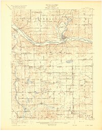
1918 Map of Lowell
USGS Topo · Published 1918About this map
The Grand River and Flat River converge at the settlement of Lowell, serving as the geographical anchor for this rural West Michigan landscape. Surveyed in 1916, the area is defined by a dense network of one-room schoolhouses, such as the Little Brick School, McPherson School, and Yerkes School, which illustrate the distributed nature of early twentieth-century rural education. Moving south from the larger river valley, the terrain becomes pocketed with glacial lakes including Pratt Lake, Camp Lake, and Middle Lake.
Find a feature on this map
89 named features on this map. Tap any name to fly to it.
Don’t see what you’re looking for? This feature index may not catch every label — zoom into the map to look around manually.
Map Details
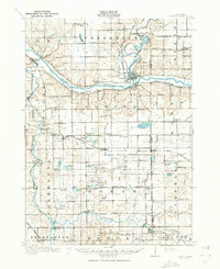
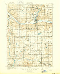
Editions of this 1918 Lowell Map
4 editions found
Other maps of this area

1914 · Grand Rapids
USGS Topo · 1:62,500

1916 · Ionia
USGS Topo · 1:62,500

1918 · Cedar Springs
USGS Topo · 1:62,500

1918 · Ionia
USGS Topo · 1:62,500

1918 · Lowell
USGS Topo · 1:62,500

1943 · Cedar Springs
USGS Topo · 1:62,500

1943 · Grand Rapids
USGS Topo · 1:62,500

1943 · Ionia
USGS Topo · 1:62,500

1943 · Lowell
USGS Topo · 1:62,500

1950 · Nashville
USGS Topo · 1:62,500
Featured Places
- Cascade Charter Township, MI
- Ada Township, MI
- Lowell Charter Township, MI
- Vergennes Township, MI
- Lowell, MI