
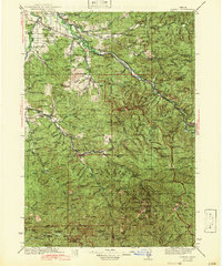
1942 Map of Lowell
USGS Topo · Published 1942About this map
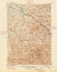
The Willamette River and its forks define this mid-century landscape where timber and transport intersected in Lane County. Surveyed in the early 1930s, the map reveals a network of rural schools like Edithvale Sch and Enterprise Sch, serving scattered settlements before the expansion of modern highways. The Southern Pacific railroad follows the river through Pengra and Lowell, while the Oregon and Southeastern line penetrates deeper into the foothills toward Dorena. High-elevation landmarks such as the Bohemia Post Office and various fire lookout towers, including Eagles Rest Lookout and Swastika Mtn Lookout, indicate the region's historical reliance on forestry management and early mining districts within the Umpqua National Forest and Willamette National Forest. This era predates the major reservoirs that would later transform these river valleys, showing the original riverine settlements and early homesteads like the Smithson Homestead.
Find a feature on this map
185 named features on this map. Tap any name to fly to it.
Don’t see what you’re looking for? This feature index may not catch every label — zoom into the map to look around manually.
Map Details
Editions of this 1942 Lowell Map
3 editions found
Other maps of this area

1897 · Roseburg
USGS Topo · 1:125,000

1900 · Roseburg
USGS Topo · 1:125,000

1910 · Eugene
USGS Topo · 1:62,500

1917 · Diamond Lake
USGS Topo · 1:125,000

1921 · Cottage Grove
USGS Topo · 1:62,500

1925 · Waldo Lake
USGS Topo · 1:125,000

1934 · Mc Kenzie Bridge
USGS Topo · 1:96,000

1935 · Lowell
USGS Topo · 1:96,000

1940 · Mc Kenzie Bridge
USGS Topo · 1:125,000

1940 · Eugene
USGS Topo · 1:62,500