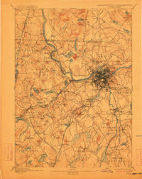
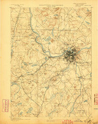
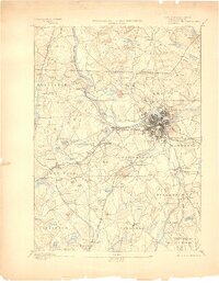
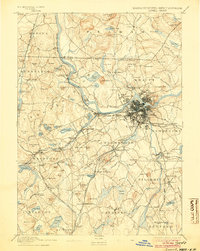
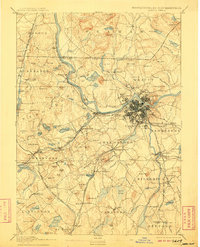
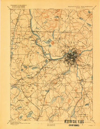
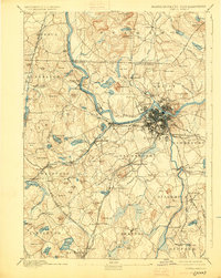
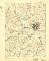
1893 Map of Lowell
USGS Topo · Published 1912About this map
Industrial Lowell serves as the focal point for this late 19th-century landscape, where the Merrimac River and Concord River meet. The geography is defined by a dense network of transit, including the Boston and Maine Railroad and various branch lines that connected the mill city to outlying rural settlements like Chelmsford Center and Forge Village. The terrain is characterized by numerous glacial features, such as Millstone Hill and Nagog Pond, which shaped the early development of Middlesex County.
Find a feature on this map
159 named features on this map. Tap any name to fly to it.
Don’t see what you’re looking for? This feature index may not catch every label — zoom into the map to look around manually.
Map Details
Editions of this 1893 Lowell Map
9 editions found
Other maps of this area

1886 · Lawrence
USGS Topo · 1:62,500

1886 · Lowell
USGS Topo · 1:62,500

1886 · Framingham
USGS Topo · 1:62,500

1887 · Marlboro
USGS Topo · 1:62,500

1888 · Haverhill
USGS Topo · 1:62,500

1888 · Lawrence
USGS Topo · 1:62,500

1889 · Marlboro
USGS Topo · 1:62,500

1889 · Framingham
USGS Topo · 1:62,500

1890 · Haverhill
USGS Topo · 1:62,500

1893 · Lowell
USGS Topo · 1:62,500