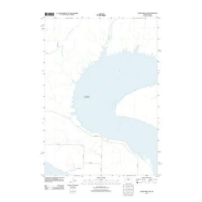
2012 Map of Lower Brule NW
USGS Topo · Published 2012About this map
The Big Bend of the Missouri dominates this central South Dakota landscape, where the river's dramatic curve forms the expansive waters of Lake Sharpe. This geography creates a distinctive peninsula defined by rural transport routes like Westbend Rd and Valley Rd, which navigate the high ground above the reservoir. Several smaller watercourses, including Arrowhead Spring Cr, Chaney Rush Cr, and Joe Cr, drain the surrounding prairie and break the shoreline into a series of points and inlets. The grid of section roads, such as Carmody Rd and Mint Rd, illustrates the persistent township-and-range surveying that organizes the ranching and agricultural land use in this part of Hughes County.
Find a feature on this map
14 named features on this map. Tap any name to fly to it.
Don’t see what you’re looking for? This feature index may not catch every label — zoom into the map to look around manually.
Map Details
Editions of this 2012 Lower Brule NW Map
This is the sole edition of this map. No revisions or reprints were ever made.
Other maps of this area

1953 · Huron
USGS Topo · 1:250,000

1954 · Huron
USGS Topo · 1:250,000

1966 · Lower Brule NW
USGS Topo · 1:24,000

1966 · Joe Creek
USGS Topo · 1:24,000

1966 · Lower Brule SW
USGS Topo · 1:24,000

1966 · Joe Creek SE
USGS Topo · 1:24,000

1966 · Lower Brule NE
USGS Topo · 1:24,000

1966 · Lower Brule
USGS Topo · 1:24,000

1973 · Chapelle Lake SE
USGS Topo · 1:24,000

1973 · De Grey SE
USGS Topo · 1:24,000