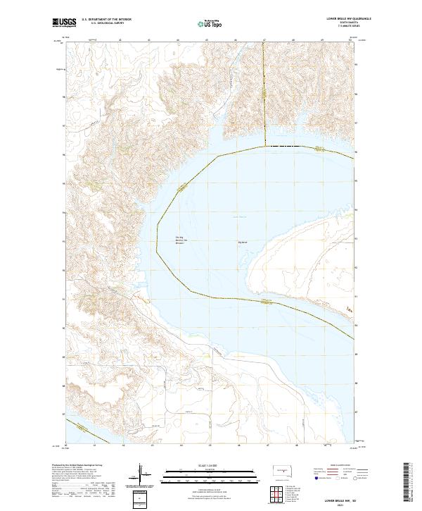
2021 Map of Lower Brule NW
USGS Topo · Published 2021About this map
The Big Bend of the Missouri creates a dramatic u-shaped loop where the river channel winds through the rugged breaks of Hughes and Lyman counties. This massive hydrological feature is largely defined by the presence of Lake Sharpe, a reservoir that occupies the valley floor. The surrounding uplands are dissected by numerous drainages, including Joe Cr, Chaney Rush Cr, and Arrowhead Spring Cr, which carve through the high plains topography. A sparse network of local tracks and section roads, such as Carmody Rd and Westbend Rd, provides access to the ranchlands and river bluffs. This survey illustrates the contrast between the vast open water of the reservoir and the intricate coulees of the Missouri River trench, a landscape shaped by both natural drainage and modern damming projects.
Find a feature on this map
23 named features on this map. Tap any name to fly to it.
Don’t see what you’re looking for? This feature index may not catch every label — zoom into the map to look around manually.
Map Details
Editions of this 2021 Lower Brule NW Map
This is the sole edition of this map. No revisions or reprints were ever made.
Other maps of this area

1953 · Huron
USGS Topo · 1:250,000

1954 · Huron
USGS Topo · 1:250,000

1966 · Lower Brule NW
USGS Topo · 1:24,000

1966 · Joe Creek
USGS Topo · 1:24,000

1966 · Lower Brule SW
USGS Topo · 1:24,000

1966 · Joe Creek SE
USGS Topo · 1:24,000

1966 · Lower Brule NE
USGS Topo · 1:24,000

1966 · Lower Brule
USGS Topo · 1:24,000

1973 · Chapelle Lake SE
USGS Topo · 1:24,000

1973 · De Grey SE
USGS Topo · 1:24,000