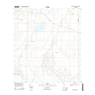
2015 Map of Lower Myakka Lake
USGS Topo · Published 2015About this map
Lower Myakka Lake and the winding Myakka River dominate this segment of the Gulf Coast interior, where wetland hydrology and prairie hammocks dictate the pattern of human settlement. The map traces the river's path south toward Deep Hole, showing how the landscape transitions from the protected environments of the state park into the developing residential corridors at the southern edge. Pockets of habitation like Shiney Town and Honore appear alongside the county line dividing Sarasota Co and Manatee Co. The presence of SR-72 and named residential loops such as Portofino Dr and Valenza Loop in the southwest corner illustrate the gradual transformation of former ranchland and river basins into contemporary Florida neighborhoods while maintaining vast stretches of open, water-logged terrain.
Find a feature on this map
20 named features on this map. Tap any name to fly to it.
Don’t see what you’re looking for? This feature index may not catch every label — zoom into the map to look around manually.
Map Details
Editions of this 2015 Lower Myakka Lake Map
This is the sole edition of this map. No revisions or reprints were ever made.
Other maps of this area

1943 · Laurel
USGS Topo · 1:24,000

1944 · Lower Myakka Lake
USGS Topo · 1:31,680

1944 · Myakka River
USGS Topo · 1:31,680

1944 · Laurel
USGS Topo · 1:31,680

1944 · Venice
USGS Topo · 1:31,680

1944 · Miakka
USGS Topo · 1:31,680

1947 · Bee Ridge
USGS Topo · 1:24,000

1956 · Murdock
USGS Topo · 1:24,000

1956 · Myakka City
USGS Topo · 1:24,000

1956 · Murdock NW
USGS Topo · 1:24,000