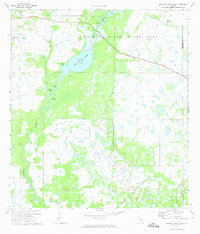
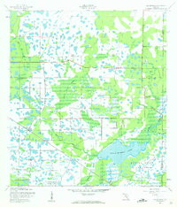
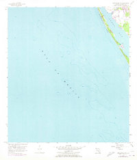
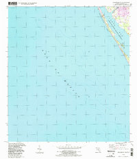
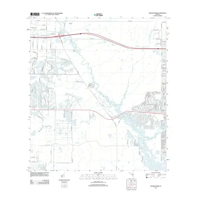
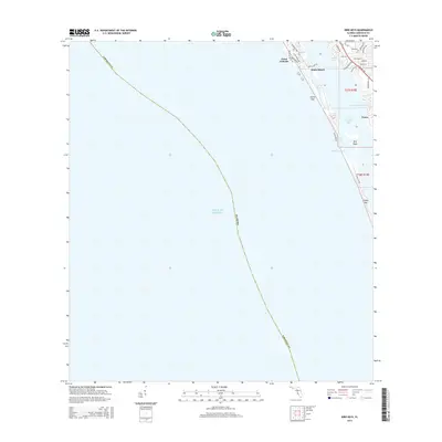
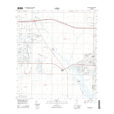
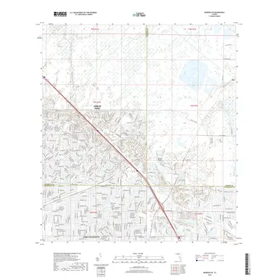
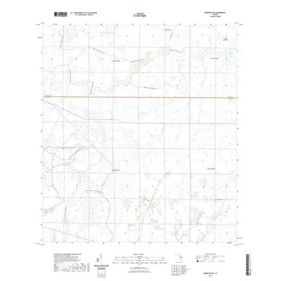
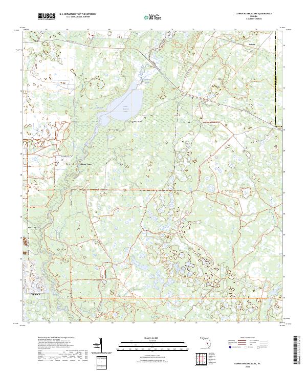
1973 Map of Lower Myakka Lake
USGS Topo · Published 1974About this map
Myakka River State Park preserves a vast wetland ecosystem where the Myakka River feeds into the expansive Lower Myakka Lake. This early 1970s survey captures a landscape defined by water and sparse settlement, highlighting the transition from the Vanderipe Slough to the prominent sinkhole known as Deep Hole. Recreational infrastructure is well-established near the river's northern bend, including a Campground, Picnic Area, and a Lookout Tower.
Find a feature on this map
18 named features on this map. Tap any name to fly to it.
Don’t see what you’re looking for? This feature index may not catch every label — zoom into the map to look around manually.
Map Details
Editions of this 1973 Lower Myakka Lake Map
This is the sole edition of this map. No revisions or reprints were ever made.
Historical Maps of Venice Through Time
62 maps found
1944 Bird Keys
Sarasota County, FL
1944 Lower Myakka Lake
Sarasota County, FL
1944 Myakka River
Sarasota County, FL
1944 Old Myakka
Sarasota County, FL
1956 Murdock NW
Sarasota County, FL
1956 Murdock
Sarasota County, FL
1956 Murdock SE
Sarasota County, FL
1957 Englewood NW
Sarasota County, FL
1973 Bird Keys
Sarasota County, FL
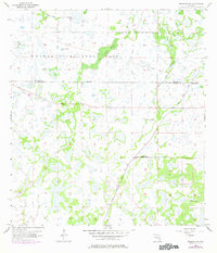
1973 Lower Myakka Lake
Sarasota County, FL
1973 Myakka River
Sarasota County, FL
1973 Old Myakka
Sarasota County, FL
1994 Englewood NW
Sarasota County, FL
2012 Bird Keys
Sarasota County, FL
2012 Englewood NW
Sarasota County, FL

2012 Lower Myakka Lake
Sarasota County, FL
2012 Murdock NW
Sarasota County, FL
2012 Murdock
Sarasota County, FL
2012 Murdock SE
Sarasota County, FL
2012 Myakka River
Sarasota County, FL
2012 Old Myakka
Sarasota County, FL

2012 Sarasota OE W
Sarasota County, FL
2015 Bird Keys
Sarasota County, FL

2015 Englewood NW
Sarasota County, FL

2015 Lower Myakka Lake
Sarasota County, FL
2015 Murdock NW
Sarasota County, FL
2015 Murdock
Sarasota County, FL
2015 Murdock SE
Sarasota County, FL
2015 Myakka River
Sarasota County, FL
2015 Old Myakka
Sarasota County, FL

2015 Sarasota OE W
Sarasota County, FL
2018 Bird Keys
Sarasota County, FL

2018 Englewood NW
Sarasota County, FL

2018 Lower Myakka Lake
Sarasota County, FL

2018 Murdock NW
Sarasota County, FL
2018 Murdock
Sarasota County, FL
2018 Murdock SE
Sarasota County, FL
2018 Myakka River
Sarasota County, FL
2018 Old Myakka
Sarasota County, FL

2018 Sarasota OE W
Sarasota County, FL
2021 Bird Keys
Sarasota County, FL

2021 Englewood NW
Sarasota County, FL

2021 Lower Myakka Lake
Sarasota County, FL
2021 Murdock NW
Sarasota County, FL
2021 Murdock
Sarasota County, FL
2021 Murdock SE
Sarasota County, FL

2021 Myakka River
Sarasota County, FL

2021 Old Myakka
Sarasota County, FL

2021 Sarasota OE W
Sarasota County, FL
2023 Murdock
Sarasota County, FL
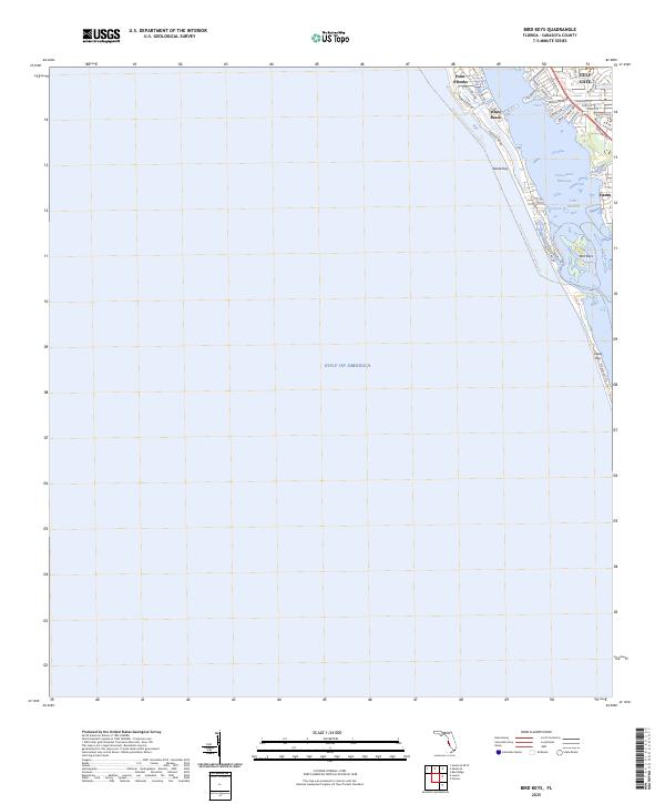
2024 Bird Keys
Sarasota County, FL

2024 Englewood NW
Sarasota County, FL
2024 Lower Myakka Lake
Sarasota County, FL
2024 Murdock NW
Sarasota County, FL
2024 Murdock
Sarasota County, FL
2024 Murdock SE
Sarasota County, FL
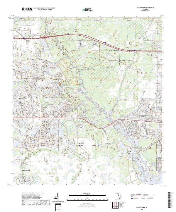
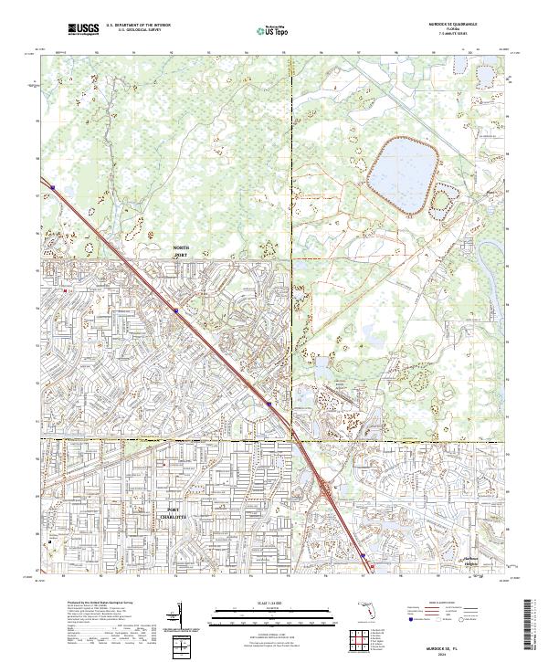
2024 Myakka River
Sarasota County, FL
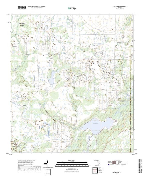
2024 Old Myakka
Sarasota County, FL

2024 Sarasota OE W
Sarasota County, FL
2025 Bird Keys
Sarasota County, FL
2025 Englewood NW
Sarasota County, FL
2025 Sarasota OE W
Sarasota County, FL