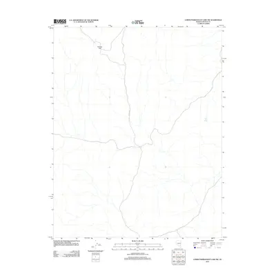
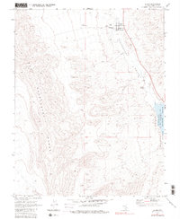
2012 Map of Lower Pahranagat Lake NW
USGS Topo · Published 2012About this map
Medsger Pass provides a vital point of navigation through the mountainous terrain of Lincoln County in this 2012 survey. The landscape is defined by its arid drainage patterns and the historic presence of paths like Old Corn Rd, which cuts through the central portion of the quadrangle. For those researching the hydrology of the Great Basin, the presence of Lower Lake Spring in the eastern hills indicates one of the few named water sources in this high-elevation desert environment. This topographic study, produced by the U.S. Geological Survey, records the land as it was documented in 2010 and 2011, capturing a rugged area where infrastructure is limited to primitive roads and natural landmarks.
Find a feature on this map
3 named features on this map. Tap any name to fly to it.
Don’t see what you’re looking for? This feature index may not catch every label — zoom into the map to look around manually.
Map Details
Editions of this 2012 Lower Pahranagat Lake NW Map
This is the sole edition of this map. No revisions or reprints were ever made.
Other maps of this area

1945 · Alamo
USGS Topo · 1:125,000

1954 · Caliente
USGS Topo · 1:250,000

1959 · Caliente
USGS Topo · 1:250,000

1969 · Alamo SE
USGS Topo · 1:24,000
1969 · Lower Pahranagat Lake SE
USGS Topo · 1:24,000

1969 · Lower Pahranagat Lake
USGS Topo · 1:24,000
1969 · Lower Pahranagat Lake SW
USGS Topo · 1:24,000
1969 · Lower Pahranagat Lake NW
USGS Topo · 1:24,000

1969 · Alamo
USGS Topo · 1:24,000
1980 · Alamo
USGS Topo · 1:24,000