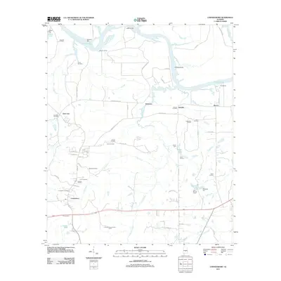
2011 Map of Lowndesboro
USGS Topo · Published 2011About this map
Lowndesboro sits at the heart of this landscape, surrounded by a network of rural settlements including Saint Clair, Burkville, and Manack. The area is defined by the winding course of the Alabama River, where features like Gun Island Chute, Huffman Bar, and Tallawassee Bar indicate a shifting, sand-bar-heavy river environment. For genealogists and local historians, the map is particularly rich in family-named burial sites, from the Alexander Cemetery in the north to the Fice Cemetery in the south, suggesting a long-established community structure.
Find a feature on this map
74 named features on this map. Tap any name to fly to it.
Don’t see what you’re looking for? This feature index may not catch every label — zoom into the map to look around manually.
Map Details
Editions of this 2011 Lowndesboro Map
This is the sole edition of this map. No revisions or reprints were ever made.
Other maps of this area

1927 · Montgomery
USGS Topo · 1:48,000

1930 · Montgomery
USGS Topo · 1:62,500

1953 · Montgomery
USGS Topo · 1:250,000

1956 · Montgomery
USGS Topo · 1:250,000

1957 · Montgomery
USGS Topo · 1:250,000

1957 · Letohatchee
USGS Topo · 1:62,500

1957 · Autaugaville
USGS Topo · 1:62,500

1958 · Montgomery
USGS Topo · 1:62,500

1975 · Autaugaville SW
USGS Topo · 1:24,000

1975 · Autaugaville SE
USGS Topo · 1:24,000