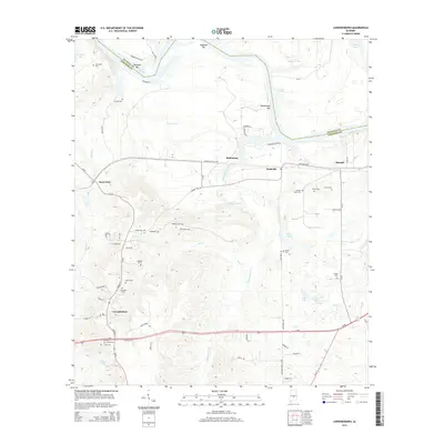
2014 Map of Lowndesboro
USGS Topo · Published 2014About this map
The town of Lowndesboro anchors this landscape, positioned south of a complex drainage network where Tallawassee Cr and Dry Cr meet. This 2014 survey reveals a territory marked by family and community history, evidenced by the high density of small cemeteries such as Yankee Town Cem, Stone Cem, and Pine Grove Cem. The northern boundary is defined by the Autauga Co Lowndes Co line as it follows the meanders of the water, passing landmarks like Huffman Bar and Newport Bar. Infrastructure is clustered around Us-80, while smaller settlements like Burkville and Saint Clair are linked by rural routes such as CR-29 and Robinson Switch Rd. The map provides an intricate view of the local topography, from the wetlands surrounding Cooter Pond and Berry Lake to the various named ponds and creeks that define the regional hydrology.
Find a feature on this map
73 named features on this map. Tap any name to fly to it.
Don’t see what you’re looking for? This feature index may not catch every label — zoom into the map to look around manually.
Map Details
Editions of this 2014 Lowndesboro Map
This is the sole edition of this map. No revisions or reprints were ever made.
Other maps of this area

1927 · Montgomery
USGS Topo · 1:48,000

1930 · Montgomery
USGS Topo · 1:62,500

1953 · Montgomery
USGS Topo · 1:250,000

1956 · Montgomery
USGS Topo · 1:250,000

1957 · Montgomery
USGS Topo · 1:250,000

1957 · Letohatchee
USGS Topo · 1:62,500

1957 · Autaugaville
USGS Topo · 1:62,500

1958 · Montgomery
USGS Topo · 1:62,500

1975 · Autaugaville SW
USGS Topo · 1:24,000

1975 · Autaugaville SE
USGS Topo · 1:24,000