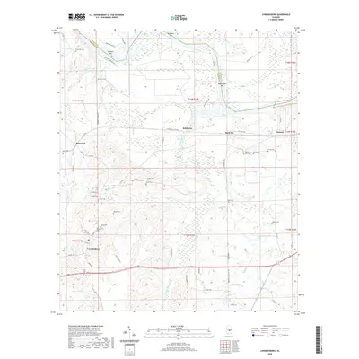
2020 Map of Lowndesboro
USGS Topo · Published 2020About this map
Lowndesboro and its surrounding hamlets sit just south of the winding border between Lowndes and Autauga counties, defined by the river bars of the Alabama River. The landscape is dotted with small-scale agricultural settlements like Burkville, Robinsons, and Manack, connected by a network of rural roads such as Robinson Switch Rd and Old Selma Rd. Significant for genealogists, the map records a high density of burial grounds including Yankee Town Cem, Pine Grove Cem, and Haigler Cem, which suggest the historic footprint of long-established family homesteads and local communities. The northern edge of the map is shaped by the river's hydrology, featuring landforms like Newport Bar and Huffman Bar alongside numerous creeks and ponds including McQueens Pond and Dickens Pond. This area reflects a quiet, rural character where historical transport routes like Newport Landing Rd once linked the hinterland to the river's commerce.
Find a feature on this map
75 named features on this map. Tap any name to fly to it.
Don’t see what you’re looking for? This feature index may not catch every label — zoom into the map to look around manually.
Map Details
Editions of this 2020 Lowndesboro Map
This is the sole edition of this map. No revisions or reprints were ever made.
Other maps of this area

1927 · Montgomery
USGS Topo · 1:48,000

1930 · Montgomery
USGS Topo · 1:62,500

1953 · Montgomery
USGS Topo · 1:250,000

1956 · Montgomery
USGS Topo · 1:250,000

1957 · Montgomery
USGS Topo · 1:250,000

1957 · Letohatchee
USGS Topo · 1:62,500

1957 · Autaugaville
USGS Topo · 1:62,500

1958 · Montgomery
USGS Topo · 1:62,500

1975 · Autaugaville SW
USGS Topo · 1:24,000

1975 · Autaugaville SE
USGS Topo · 1:24,000