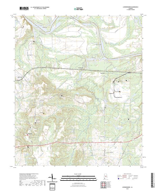
2024 Map of Lowndesboro
USGS Topo · Published 2024About this map
Lowndesboro anchors the southern portion of this landscape, where the street grid of the town center meets the surrounding agricultural and swampy bottomlands. The terrain is defined by the winding course of the Alabama River, including the R E 'Bob' Woodruff Reservoir and distinctive features like Tallawassee Bar and Hickory Point. This area reflects a deep-rooted rural history, evident in the high density of family and community burial grounds, such as Yankee Town Cem and Oakview Cem.
Find a feature on this map
75 named features on this map. Tap any name to fly to it.
Don’t see what you’re looking for? This feature index may not catch every label — zoom into the map to look around manually.
Map Details
Editions of this 2024 Lowndesboro Map
This is the sole edition of this map. No revisions or reprints were ever made.
Other maps of this area

1927 · Montgomery
USGS Topo · 1:48,000

1930 · Montgomery
USGS Topo · 1:62,500

1953 · Montgomery
USGS Topo · 1:250,000

1956 · Montgomery
USGS Topo · 1:250,000

1957 · Montgomery
USGS Topo · 1:250,000

1957 · Letohatchee
USGS Topo · 1:62,500

1957 · Autaugaville
USGS Topo · 1:62,500

1958 · Montgomery
USGS Topo · 1:62,500

1975 · Autaugaville SW
USGS Topo · 1:24,000

1975 · Autaugaville SE
USGS Topo · 1:24,000