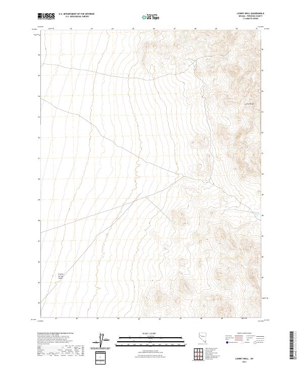
2021 Map of Lowry Well
USGS Topo · Published 2021About this map
Granite Springs Valley defines the western expanse of this high-desert landscape in Pershing County, where the transition from flat basin floor to the rising elevations of the Trinity Range is clearly marked by intricate contouring. This 2021 topographic record of the area reveals a geography shaped by drainage patterns and arid slopes, with very few named water sources in the region. One such notable point of interest is J Marzen Spring, located on the eastern slopes, which serves as a rare landmark in a terrain dominated by the expansive public land survey system. The grid-like division of townships and ranges, such as t27n r28e, provides a precise structural framework over a territory that remains largely undeveloped and defined by its natural topography.
Find a feature on this map
9 named features on this map. Tap any name to fly to it.
Don’t see what you’re looking for? This feature index may not catch every label — zoom into the map to look around manually.
Map Details
Editions of this 2021 Lowry Well Map
This is the sole edition of this map. No revisions or reprints were ever made.
Other maps of this area

1931 · Lovelock
USGS Topo · 1:250,000

1935 · Lovelock
USGS Topo · 1:250,000

1955 · Lovelock
USGS Topo · 1:250,000

1956 · Toulon
USGS Topo · 1:62,500

1959 · Lovelock
USGS Topo · 1:250,000
1981 · Bluewing Flat South
USGS Topo · 1:24,000

1981 · Bluewing Flat North
USGS Topo · 1:24,000
1981 · Ragged Top Mtn
USGS Topo · 1:24,000

1981 · Trinity Pass
USGS Topo · 1:24,000
1981 · Lowry Well
USGS Topo · 1:24,000