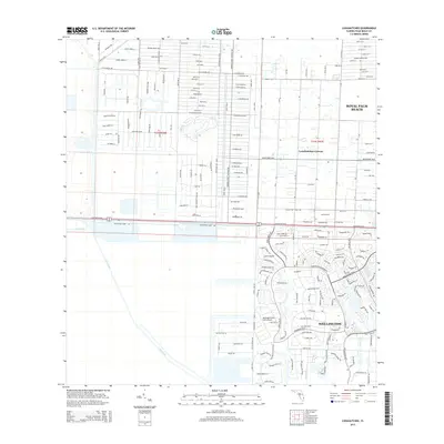
2015 Map of Loxahatchee
USGS Topo · Published 2015About this map
The West Palm Beach Canal and L-40 Canal anchor this landscape of structured agricultural lots and suburban expansion in Palm Beach County. The map details a unique transition from the high-density residential developments of Wellington and Royal Palm Beach to the more rural, large-lot residential farms of Loxahatchee Groves. A distinct grid of numbered roads, such as 40th St N and 49th St N, organizes the northern half of the quadrangle, while the southern section reveals specialized infrastructure like the Wellington Aero Club Airport and various equestrian-themed street names. This network of canals and thoroughfares like Okeechobee Blvd and Southern Blvd illustrates the sophisticated water management and transportation systems required to maintain these inland Florida communities.
Find a feature on this map
25 named features on this map. Tap any name to fly to it.
Don’t see what you’re looking for? This feature index may not catch every label — zoom into the map to look around manually.
Map Details
Editions of this 2015 Loxahatchee Map
This is the sole edition of this map. No revisions or reprints were ever made.
Other maps of this area

1945 · Delta
USGS Topo · 1:24,000

1945 · Greenacres City
USGS Topo · 1:24,000

1946 · Palm Beach Farms
USGS Topo · 1:24,000

1949 · Palm Beach Farms
USGS Topo · 1:24,000

1950 · Greenacres City
USGS Topo · 1:24,000

1950 · Delta
USGS Topo · 1:24,000

1956 · West Palm Beach
USGS Topo · 1:250,000

1957 · West Palm Beach
USGS Topo · 1:250,000

1958 · West Palm Beach
USGS Topo · 1:250,000

1970 · West Palm Beach 2 SW
USGS Topo · 1:24,000