2018 Map of Loxahatchee
USGS Topo · Published 2018About this map
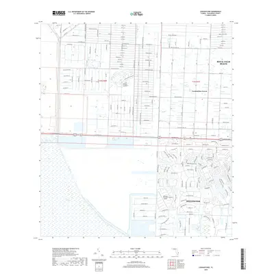
The Everglades define the western margin of this survey, where the managed waterways of the L-40 Canal and L-7 Canal meet the vast conservation areas of South Florida. To the east, the landscape transitions into the distinctive residential and agricultural grid of Loxahatchee Groves, characterized by large lots and a high density of named roads like Orange Grove Blvd and Sycamore Dr W. The Southern portion of the map highlights the equestrian-centered development of Wellington, featuring the Wellington Aero Club Airport and complex neighborhood networks. The West Palm Beach Canal serves as a major hydrologic artery through the center of the sheet, separating the suburban growth of Royal Palm Beach from the leisure and tourism landmarks like Lion Country Safari Rd. This map documents a critical interface between massive water management infrastructure and rapid residential expansion in the late 2010s.
Find a feature on this map
174 named features on this map. Tap any name to fly to it.
Don’t see what you’re looking for? This feature index may not catch every label — zoom into the map to look around manually.
Map Details
Editions of this 2018 Loxahatchee Map
This is the sole edition of this map. No revisions or reprints were ever made.
Other maps of this area

1945 · Delta
USGS Topo · 1:24,000

1945 · Greenacres City
USGS Topo · 1:24,000

1946 · Palm Beach Farms
USGS Topo · 1:24,000

1949 · Palm Beach Farms
USGS Topo · 1:24,000

1950 · Greenacres City
USGS Topo · 1:24,000

1950 · Delta
USGS Topo · 1:24,000

1956 · West Palm Beach
USGS Topo · 1:250,000

1957 · West Palm Beach
USGS Topo · 1:250,000

1958 · West Palm Beach
USGS Topo · 1:250,000

1970 · West Palm Beach 2 SW
USGS Topo · 1:24,000