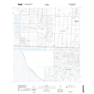
2021 Map of Loxahatchee
USGS Topo · Published 2021About this map
The Everglades define the western margin of this landscape, where the Arthur R Marshall Loxahatchee National Wildlife Refuge Trail marks the boundary between preserved wetlands and expanding residential development. The intricate network of drainage, featuring the West Palm Beach Canal, M Canal, and L-7 Canal, illustrates the engineered hydrology required to sustain communities like Westlake and Loxahatchee Groves. To the southeast, the planned layout of Wellington is visible, including the Wellington Aero Club Airport and an extensive system of Equestrian Trails. This modern survey highlights the proximity of urban institutions, such as the Palm Beach State College Loxahatchee Campus, to the edge of the Florida wild, while the grid of Royal Palm Beach shows the continued growth of Palm Beach County's interior.
Find a feature on this map
19 named features on this map. Tap any name to fly to it.
Don’t see what you’re looking for? This feature index may not catch every label — zoom into the map to look around manually.
Map Details
Editions of this 2021 Loxahatchee Map
This is the sole edition of this map. No revisions or reprints were ever made.
Other maps of this area

1945 · Delta
USGS Topo · 1:24,000

1945 · Greenacres City
USGS Topo · 1:24,000

1946 · Palm Beach Farms
USGS Topo · 1:24,000

1949 · Palm Beach Farms
USGS Topo · 1:24,000

1950 · Greenacres City
USGS Topo · 1:24,000

1950 · Delta
USGS Topo · 1:24,000

1956 · West Palm Beach
USGS Topo · 1:250,000

1957 · West Palm Beach
USGS Topo · 1:250,000

1958 · West Palm Beach
USGS Topo · 1:250,000

1970 · West Palm Beach 2 SW
USGS Topo · 1:24,000