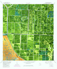
1979 Map of Loxahatchee
USGS Topo · Published 1984About this map
Loxahatchee National Wildlife Refuge and Conservation Area No 1 dominate the southwestern portion of this orthophotomap, showing the stark transition between preserved wetlands and the emerging citrus and agricultural grid. This 1980s-era study reveals a landscape defined by hydraulic engineering, where the West Palm Beach Canal, L-8 Canal, and L-7 Canal dictate the movement of water across the flat terrain. Evidence of regional development and leisure appears in the form of a Zoological Garden and Recreation Area 6, complete with its own Boat Ramp. The map captures a moment when the settlement of Loxahatchee was comprised of large rectangular parcels and specialized infrastructure like a Landing Strip and multiple Radio Towers, illustrating the rural-to-suburban evolution of Palm Beach County.
Find a feature on this map
13 named features on this map. Tap any name to fly to it.
Don’t see what you’re looking for? This feature index may not catch every label — zoom into the map to look around manually.
Map Details
Editions of this 1979 Loxahatchee Map
This is the sole edition of this map. No revisions or reprints were ever made.
Other maps of this area

1945 · Delta
USGS Topo · 1:24,000

1945 · Greenacres City
USGS Topo · 1:24,000

1946 · Palm Beach Farms
USGS Topo · 1:24,000

1949 · Palm Beach Farms
USGS Topo · 1:24,000

1950 · Greenacres City
USGS Topo · 1:24,000

1950 · Delta
USGS Topo · 1:24,000

1956 · West Palm Beach
USGS Topo · 1:250,000

1957 · West Palm Beach
USGS Topo · 1:250,000

1958 · West Palm Beach
USGS Topo · 1:250,000

1970 · West Palm Beach 2 SW
USGS Topo · 1:24,000