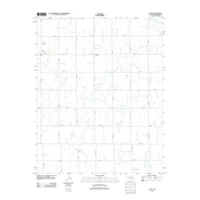
2012 Map of Loyal
USGS Topo · Published 2012About this map
Loyal anchors this section of Kingfisher County, situated in an area where the agricultural grid meets the natural winding paths of the local watershed. The landscape is defined by the proximity of the Cimarron River in the northeast corner and the branching network of Cooper Cr, Felter Br, and Treaty Cr. These waterways carve through the section-line road network, which includes numerous local routes like n2770 RD and e0730 RD. Community history is anchored by the Saint Joseph Catholic Cem near the town center and the Greenwood Cem further south. The small settlement of Oneida appears as a secondary landmark, illustrating the dispersed rural settlement pattern typical of the Oklahoma prairie in the early 21st century. The map provides a clear look at how human infrastructure, from local streets like 1st ST and 4th ST to expansive rural roads, adapts to the hydrology of the plains.
Find a feature on this map
25 named features on this map. Tap any name to fly to it.
Don’t see what you’re looking for? This feature index may not catch every label — zoom into the map to look around manually.
Map Details
Editions of this 2012 Loyal Map
This is the sole edition of this map. No revisions or reprints were ever made.
Other maps of this area

1892 · Kingfisher
USGS Topo · 1:125,000

1893 · Hennessey
USGS Topo · 1:62,500

1893 · Loyal
USGS Topo · 1:62,500

1893 · Ames
USGS Topo · 1:62,500

1895 · Kingfisher
USGS Topo · 1:125,000

1954 · Oklahoma City
USGS Topo · 1:250,000

1955 · Clinton
USGS Topo · 1:250,000

1955 · Enid
USGS Topo · 1:250,000

1955 · Woodward
USGS Topo · 1:250,000

1956 · Ames
USGS Topo · 1:62,500