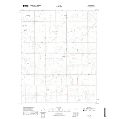
2018 Map of Loyal
USGS Topo · Published 2018About this map
Loyal serves as the primary settlement hub in this Kingfisher County landscape, located in the northwestern reaches where the Cimarron River cuts across the corner of the survey. The community structure is defined by a dense grid of section-line roads, such as Co RD e0720 and n2740 RD, reflecting the organized land division of the Oklahoma plains. Smaller locales like Oneida appear along these routes, supported by several burial grounds that offer significant value for genealogical research, including Greenwood Cem, New Home Cem, and the Forest Home Cem. The drainage of the region is shaped by several waterways, notably Cooper Cr, Felter Br, and Treaty Cr, which meander through the agricultural plots. These natural features, alongside man-made landmarks like the 07310 Reservoir, illustrate the water management essential to this rural prairie environment.
Find a feature on this map
37 named features on this map. Tap any name to fly to it.
Don’t see what you’re looking for? This feature index may not catch every label — zoom into the map to look around manually.
Map Details
Editions of this 2018 Loyal Map
This is the sole edition of this map. No revisions or reprints were ever made.
Other maps of this area
1892 · Kingfisher
USGS Topo · 1:125,000
1893 · Hennessey
USGS Topo · 1:62,500
1893 · Loyal
USGS Topo · 1:62,500
1893 · Ames
USGS Topo · 1:62,500
1895 · Kingfisher
USGS Topo · 1:125,000
1954 · Oklahoma City
USGS Topo · 1:250,000

1955 · Clinton
USGS Topo · 1:250,000

1955 · Enid
USGS Topo · 1:250,000

1955 · Woodward
USGS Topo · 1:250,000
1956 · Ames
USGS Topo · 1:62,500