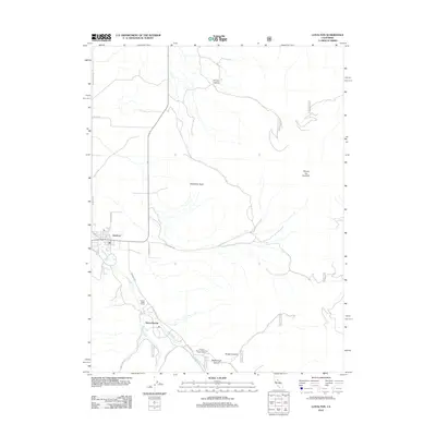
2012 Map of Loyalton
USGS Topo · Published 2012About this map
Loyalton serves as the primary hub in this Sierra County valley, where the town’s street grid meets the open terrain of the Sierra Valley. The landscape transition is evident where the residential streets of Loyalton give way to rural landmarks like Clover Valley Ranch and the newer residential cluster of Sierra Brooks. Historically significant features include Railroad Ave, signaling the area's older transportation ties, and the Alvin A Powers Memorial Picnic Grove located near the southern drainage of Smithneck Cr.
Find a feature on this map
24 named features on this map. Tap any name to fly to it.
Don’t see what you’re looking for? This feature index may not catch every label — zoom into the map to look around manually.
Map Details
Editions of this 2012 Loyalton Map
This is the sole edition of this map. No revisions or reprints were ever made.
Other maps of this area

1890 · Sierraville
USGS Topo · 1:125,000

1892 · Sierraville
USGS Topo · 1:125,000

1894 · Sierraville
USGS Topo · 1:125,000

1950 · Chilcoot
USGS Topo · 1:62,500

1950 · Portola
USGS Topo · 1:62,500

1955 · Loyalton
USGS Topo · 1:62,500

1955 · Sierraville
USGS Topo · 1:62,500

1958 · Chico
USGS Topo · 1:250,000

1960 · Chico
USGS Topo · 1:250,000
1972 · Reconnaissance Peak
USGS Topo · 1:24,000