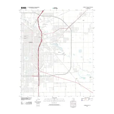
2010 Map of Lubbock East
USGS Topo · Published 2010About this map
Lubbock serves as the focal point of this High Plains landscape, where the urban grid meets the agricultural and industrial outskirts of the Llano Estacado. The geography is defined by the convergence of Yellow House Draw and Blackwater Draw, which feed into the North Fork Double Mountain Fork Brazos River. This drainage system, which includes Canyon Lake Number 6, creates a distinct greenbelt through the city.
Find a feature on this map
46 named features on this map. Tap any name to fly to it.
Don’t see what you’re looking for? This feature index may not catch every label — zoom into the map to look around manually.
Map Details
Editions of this 2010 Lubbock East Map
This is the sole edition of this map. No revisions or reprints were ever made.
Other maps of this area

1954 · Lubbock
USGS Topo · 1:250,000

1956 · Shallowater
USGS Topo · 1:24,000

1956 · New Deal
USGS Topo · 1:24,000

1957 · Lubbock East
USGS Topo · 1:24,000

1957 · New Home
USGS Topo · 1:62,500

1957 · Lubbock West
USGS Topo · 1:24,000

1957 · Lubbock
USGS Topo · 1:62,500

1965 · Slaton
USGS Topo · 1:24,000

1965 · Buffalo Springs Lake
USGS Topo · 1:24,000

1965 · Idalou
USGS Topo · 1:24,000