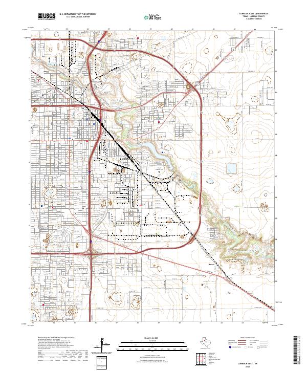
2022 Map of Lubbock East
USGS Topo · Published 2022About this map
The Lubbock County Courthouse anchors the urban core of this West Texas landscape, where the city's grid meets the natural geography of the Llano Estacado. This area is defined by the convergence of the Yellow House Draw and Blackwater Draw, which carve through the plains to form Yellow House Canyon. Within this drainage system, several managed water bodies like Canyon Lake Number 2 and Blake Lake dot the terrain. The eastern reaches of Lubbock show a dense concentration of civic and educational institutions, including Texas Tech University and the American Commercial College. Industrial and transportation history is visible through the BNSF Railway lines and thoroughfares like Clovis Rd and Idalou Rd. Further south, the settlement of Burris sits near the N Fork Double Mountain Fork Brazos River, illustrating the historical importance of these watercourses in an otherwise arid region.
Find a feature on this map
27 named features on this map. Tap any name to fly to it.
Don’t see what you’re looking for? This feature index may not catch every label — zoom into the map to look around manually.
Map Details
Editions of this 2022 Lubbock East Map
This is the sole edition of this map. No revisions or reprints were ever made.
Other maps of this area

1954 · Lubbock
USGS Topo · 1:250,000

1956 · Shallowater
USGS Topo · 1:24,000

1956 · New Deal
USGS Topo · 1:24,000

1957 · Lubbock East
USGS Topo · 1:24,000

1957 · New Home
USGS Topo · 1:62,500

1957 · Lubbock West
USGS Topo · 1:24,000

1957 · Lubbock
USGS Topo · 1:62,500

1965 · Slaton
USGS Topo · 1:24,000

1965 · Buffalo Springs Lake
USGS Topo · 1:24,000

1965 · Idalou
USGS Topo · 1:24,000