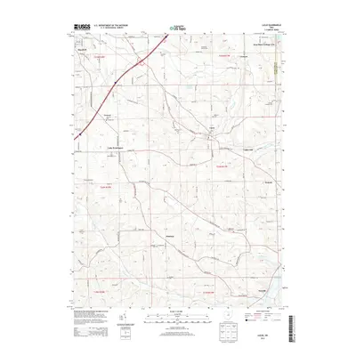
2013 Map of Lucas
USGS Topo · Published 2013About this map
Lucas sits at the heart of this survey, surrounded by a landscape defined by the winding course of Rocky Fork and numerous small-scale agricultural settlements. The area shows a high density of nineteenth-century burial grounds, including the Odd Fellows Cem, Caesarea Cem, and Mt Zion Lutheran Cem, which offer significant research potential for local genealogists. In the southern portion of the quadrangle, the terrain becomes increasingly defined by water as Possum Run and Switzer Cr drain toward the Clear Fork Mohican River and the edges of Pleasant Hill Lake. Small communities and family farms like Shererwood Farm and Equestrian Valley Farm are scattered throughout, linked by a network of rural roads such as Mansfield Lucas Rd and Lucas Perrysville Rd. The presence of Culler Mill and Pinhook indicates the historical importance of localized industry and commerce in these rural Ohio townships.
Find a feature on this map
75 named features on this map. Tap any name to fly to it.
Don’t see what you’re looking for? This feature index may not catch every label — zoom into the map to look around manually.
Map Details
Editions of this 2013 Lucas Map
This is the sole edition of this map. No revisions or reprints were ever made.
Other maps of this area

1908 · Ashland
USGS Topo · 1:62,500

1912 · Perrysville
USGS Topo · 1:62,500

1915 · Crestline
USGS Topo · 1:62,500

1915 · Perrysville
USGS Topo · 1:62,500

1915 · Shauck
USGS Topo · 1:62,500

1943 · Shauck
USGS Topo · 1:62,500

1943 · Crestline
USGS Topo · 1:62,500

1944 · Perrysville
USGS Topo · 1:62,500

1950 · Marion
USGS Topo · 1:250,000

1960 · Pavonia
USGS Topo · 1:24,000