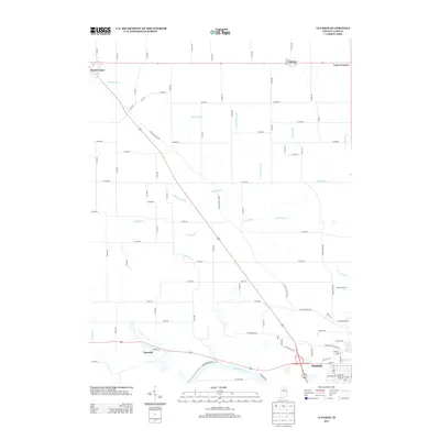
2013 Map of Lucerne
USGS Topo · Published 2013About this map
Wabash River frontage near Dunkirk anchors the southern boundary of this 2013 survey of north-central Indiana. The landscape is defined by an extensive drainage network, including Fredricks Ditch, Miller Ditch, and Umbenhour Ditch, which support the region's agricultural productivity between the small rural hubs of Lucerne and Royal Center. This grid-based road system reflects a long history of township development, connecting outlying settlements like Leases Corner and Kenneth. A notable modern landmark, the Skyline Drive-In, sits along the southeastern corridor near Indian Creek Rd, representing a surviving piece of 20th-century Americana in an otherwise predominantly agrarian landscape. The map captures the precise intersection of rail and road corridors that shaped the growth of these Cass County communities.
Find a feature on this map
67 named features on this map. Tap any name to fly to it.
Don’t see what you’re looking for? This feature index may not catch every label — zoom into the map to look around manually.
Map Details
Editions of this 2013 Lucerne Map
This is the sole edition of this map. No revisions or reprints were ever made.
Other maps of this area

1953 · Danville
USGS Topo · 1:250,000

1955 · Danville
USGS Topo · 1:250,000

1955 · Logansport
USGS Topo · 1:24,000

1955 · Anoka
USGS Topo · 1:24,000

1956 · Danville
USGS Topo · 1:250,000

1960 · Lucerne
USGS Topo · 1:24,000

1960 · Fulton
USGS Topo · 1:24,000

1960 · Grass Creek
USGS Topo · 1:24,000

1962 · Burrows
USGS Topo · 1:24,000

1962 · Star City
USGS Topo · 1:24,000