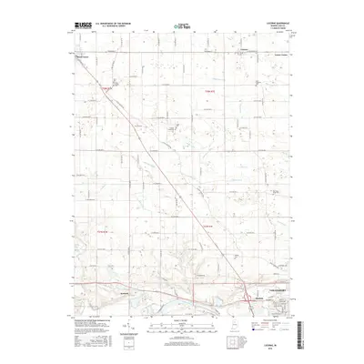
2016 Map of Lucerne
USGS Topo · Published 2016About this map
The Wabash River meanders across the southern portion of this region, providing a natural southern boundary for the burgeoning city of Logansport. North of the river, the landscape is defined by an intricate network of drainage systems, including Umbenhour Ditch, Miller Ditch, and McNitt Ditch, which support the agricultural productivity of Cass County. This 2016 survey illustrates the persistent rural character of North Central Indiana, where small settlements like Lucerne and Kenneth are linked by long-established thoroughfares such as Royal Center Pike. Genealogists will find a wealth of data in the numerous family and community burial sites scattered across the townships, from Cline Cem in the northwest to East Sand Ridge Cem in the east. The intersection of rail history and river geography is evident near the town of Royal Center, revealing how transport patterns shaped these prairie communities.
Find a feature on this map
45 named features on this map. Tap any name to fly to it.
Don’t see what you’re looking for? This feature index may not catch every label — zoom into the map to look around manually.
Map Details
Editions of this 2016 Lucerne Map
This is the sole edition of this map. No revisions or reprints were ever made.
Other maps of this area
1953 · Danville
USGS Topo · 1:250,000
1955 · Danville
USGS Topo · 1:250,000
1955 · Logansport
USGS Topo · 1:24,000
1955 · Anoka
USGS Topo · 1:24,000
1956 · Danville
USGS Topo · 1:250,000
1960 · Lucerne
USGS Topo · 1:24,000
1960 · Fulton
USGS Topo · 1:24,000
1960 · Grass Creek
USGS Topo · 1:24,000
1962 · Burrows
USGS Topo · 1:24,000
1962 · Star City
USGS Topo · 1:24,000