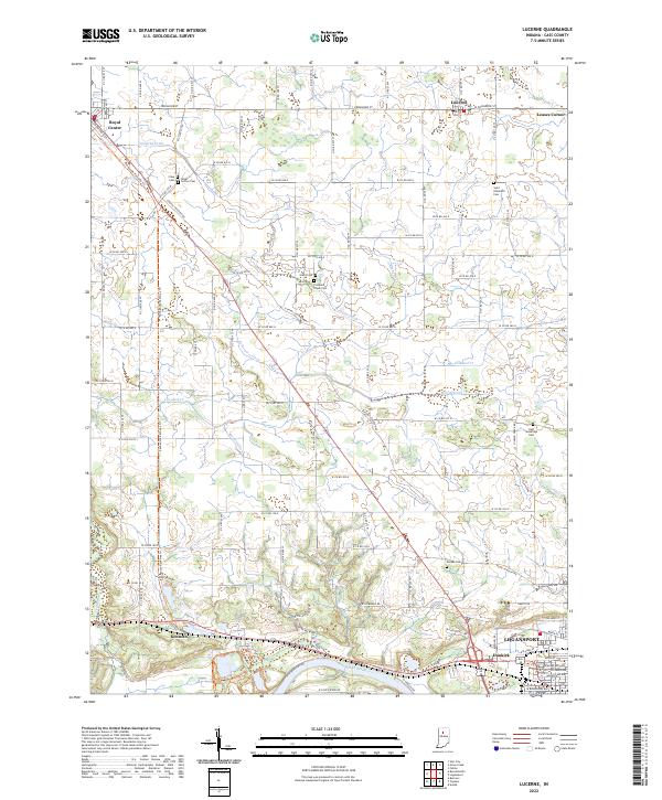
2022 Map of Lucerne
USGS Topo · Published 2022About this map
The Wabash River valley anchors the southern edge of this landscape, where the settlements of Logansport, Dunkirk, and Kenneth are established along the river's north bank. Further north, the terrain transitions into a highly managed agricultural plain defined by an extensive network of drainage features like Fredricks Ditch, Miller Ditch, and Forgey Ditch, which support the farms surrounding Lucerne and Royal Center. For genealogists, the map preserves the locations of several community burial grounds, including Saint Elizabeth Cem near Leases Corner and the isolated Harper Cem. The Panhandle Pathway Trl follows the old railroad grade through the heart of the county, cutting diagonally past Cline Cem and illustrating the enduring influence of historic transport corridors on modern recreation and land use.
Find a feature on this map
64 named features on this map. Tap any name to fly to it.
Don’t see what you’re looking for? This feature index may not catch every label — zoom into the map to look around manually.
Map Details
Editions of this 2022 Lucerne Map
This is the sole edition of this map. No revisions or reprints were ever made.
Other maps of this area

1953 · Danville
USGS Topo · 1:250,000

1955 · Danville
USGS Topo · 1:250,000

1955 · Logansport
USGS Topo · 1:24,000

1955 · Anoka
USGS Topo · 1:24,000

1956 · Danville
USGS Topo · 1:250,000

1960 · Lucerne
USGS Topo · 1:24,000

1960 · Fulton
USGS Topo · 1:24,000

1960 · Grass Creek
USGS Topo · 1:24,000

1962 · Burrows
USGS Topo · 1:24,000

1962 · Star City
USGS Topo · 1:24,000