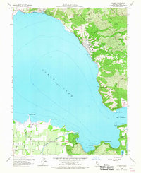
1958 Map of Lucerne
USGS Topo · Published 1967About this map
The northern and western shores of Clear Lake dominate this 1958 survey, revealing a landscape defined by the transition from steep mountain slopes to fertile basin flats. Along the northern bank, the communities of Nice and Lucerne hug the shoreline, while the southern reaches of the map transition into the expansive agricultural land of Big Valley. This area, primarily near Finley, is marked by a systematic grid of orchards and wells, drawing from water sources like Kelsey Creek and Adobe Creek. In the southeast, the rugged topography of the Mendocino National Forest gives way to the unique geothermal features of Soda Bay, including the thermal activity at Big Soda Spr. Public recreation and conservation areas are already well-established, with Clear Lake State Park and Buckingham Park preserving significant portions of the waterfront for future generations.
Find a feature on this map
51 named features on this map. Tap any name to fly to it.
Don’t see what you’re looking for? This feature index may not catch every label — zoom into the map to look around manually.
Map Details
Editions of this 1958 Lucerne Map
4 editions found
Other maps of this area

1921 · Kelseyville
USGS Topo · 1:62,500

1924 · Bartlett Springs
USGS Topo · 1:62,500

1938 · Lakeport
USGS Topo · 1:62,500

1942 · Bartlett Springs
USGS Topo · 1:62,500

1943 · Kelseyville
USGS Topo · 1:62,500

1944 · Bartlett Springs
USGS Topo · 1:62,500

1945 · Lower Lake
USGS Topo · 1:62,500

1947 · Santa Rosa
USGS Topo · 1:250,000

1949 · Santa Rosa
USGS Topo · 1:250,000

1951 · Lakeport
USGS Topo · 1:62,500