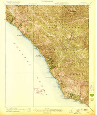
1921 Map of Lucia
USGS Topo · Published 1921About this map
The Santa Barbara National Forest dominates this coastal section of Monterey County, where the steep canyons of the Santa Lucia Range meet the Pacific Ocean. Surveyed in 1917, the map records a remote landscape of family-named settlements and maritime access points before the modern highway era. Coastal commerce relied on sites like Anderson Landing and Rockland Landing, while the interior was characterized by isolated homesteads and cabins, such as Higgins Cabin and the cluster of Borondas, Avilas, and Harlans.
Find a feature on this map
44 named features on this map. Tap any name to fly to it.
Don’t see what you’re looking for? This feature index may not catch every label — zoom into the map to look around manually.
Map Details
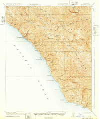
Editions of this 1921 Lucia Map
4 editions found

Other maps of this area

1915 · Soledad
USGS Topo · 1:62,500

1918 · Point Sur
USGS Topo · 1:62,500

1919 · Junipero Serra
USGS Topo · 1:62,500

1920 · Jamesburg
USGS Topo · 1:48,000

1921 · Cape San Martin
USGS Topo · 1:62,500

1921 · Jamesburg
USGS Topo · 1:62,500
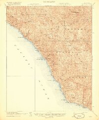
1921 · Lucia
USGS Topo · 1:62,500

1925 · Point Sur
USGS Topo · 1:62,500

1939 · Jamesburg
USGS Topo · 1:62,500

1940 · Jamesburg
USGS Topo · 1:62,500