1991 Map of Lucin 4 NE
USGS Topo · Published 1992About this map
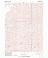
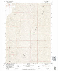
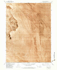
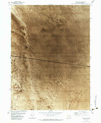
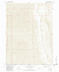
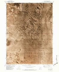
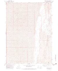
Mud Basin dominates this desolate landscape in northwestern Utah, where the terrain is defined by vast expanses of Mud and a large Evaporation zone. The topographical data, revised from 1987 aerial photography, reveals the presence of isolated water sources in this arid environment, specifically the Flowing Wells in the northwest and a single Flowing Well further south. These features suggest the presence of artesian pressure in a region otherwise characterized by the dry salt flats of the Newfoundland area. The map illustrates a landscape of extreme drainage patterns, providing a precise record of the shoreline and surface composition of the Great Salt Lake desert floor before further modern industrial or environmental shifts.
Find a feature on this map
6 named features on this map. Tap any name to fly to it.
Don’t see what you’re looking for? This feature index may not catch every label — zoom into the map to look around manually.
Map Details
Editions of this 1991 Lucin 4 NE Map
2 editions found
Other maps of this area

1954 · Brigham City
USGS Topo · 1:250,000

1958 · Brigham City
USGS Topo · 1:250,000

1962 · Brigham City
USGS Topo · 1:250,000
1983 · Jackson
USGS Topo · 1:24,000
1983 · Lemay
USGS Topo · 1:24,000
1983 · Lucin 4 SW
USGS Topo · 1:24,000
1983 · Bovine SE
USGS Topo · 1:24,000
1983 · Big Pass
USGS Topo · 1:24,000
1983 · Lucin 4 NE
USGS Topo · 1:24,000
1983 · Miners Basin
USGS Topo · 1:24,000