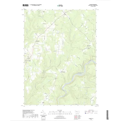
2019 Map of Lucinda
USGS Topo · Published 2019About this map
Clarion Wild and Scenic River carves a deep, winding path through this Clarion County landscape, defining the topography between Miola and Scotch Hill. The map documents a corridor of small settlements and historical sites, such as Helen Furnace and its nearby Helen Furnace Cem. This area, primarily characterized by steep drainages like Toby Cr and Callihan Run, is also home to the N Country National Scenic Trail, which traverses the hillsides overlooking the river. In the western portion of the quadrangle, the community of Lucinda and the Saint Joseph Cem sit along Rte 66, reflecting a long-standing rural settlement pattern. The presence of Frederick Airpark near Leeper at the northern edge suggests modern utility amidst the traditional woodland and creek valleys of the region.
Find a feature on this map
44 named features on this map. Tap any name to fly to it.
Don’t see what you’re looking for? This feature index may not catch every label — zoom into the map to look around manually.
Map Details
Editions of this 2019 Lucinda Map
This is the sole edition of this map. No revisions or reprints were ever made.
Other maps of this area

1906 · Clarion
USGS Topo · 1:62,500

1907 · Clarion
USGS Topo · 1:62,500

1918 · Loleta
USGS Topo · 1:62,500

1922 · Tionesta
USGS Topo · 1:62,500

1924 · Tionesta
USGS Topo · 1:62,500

1924 · Brookville
USGS Topo · 1:62,500

1926 · Brookville
USGS Topo · 1:62,500

1936 · Marienville
USGS Topo · 1:48,000

1941 · Marienville
USGS Topo · 1:62,500

1944 · Brookville
USGS Topo · 1:62,500