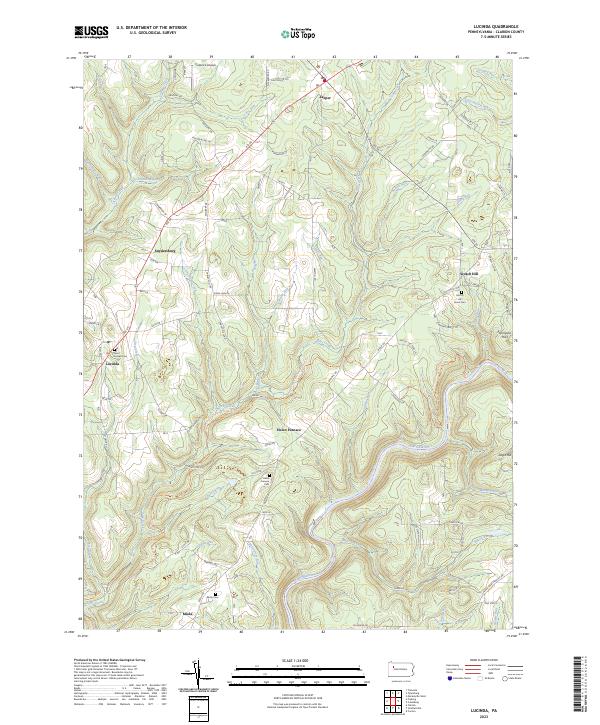
2023 Map of Lucinda
USGS Topo · Published 2023About this map
The Clarion Wild and Scenic River meanders deeply through this portion of Clarion County, defining a landscape where small settlements like Lucinda and Leeper are connected by the corridor of Rte 66. This area is characterized by a high density of small watercourses, including Toby Creek, Frills Run, and Step Creek, which drain the elevated terrain of Zagst Hill and Thompson Hill.
Find a feature on this map
97 named features on this map. Tap any name to fly to it.
Don’t see what you’re looking for? This feature index may not catch every label — zoom into the map to look around manually.
Map Details
Editions of this 2023 Lucinda Map
This is the sole edition of this map. No revisions or reprints were ever made.
Other maps of this area

1906 · Clarion
USGS Topo · 1:62,500

1907 · Clarion
USGS Topo · 1:62,500

1918 · Loleta
USGS Topo · 1:62,500

1922 · Tionesta
USGS Topo · 1:62,500

1924 · Tionesta
USGS Topo · 1:62,500

1924 · Brookville
USGS Topo · 1:62,500

1926 · Brookville
USGS Topo · 1:62,500

1936 · Marienville
USGS Topo · 1:48,000

1941 · Marienville
USGS Topo · 1:62,500

1944 · Brookville
USGS Topo · 1:62,500
Featured Places
- Paint Township, PA
- Farmington Township, PA
- Highland Township, PA
- Knox Township, PA
- Millcreek Township, PA