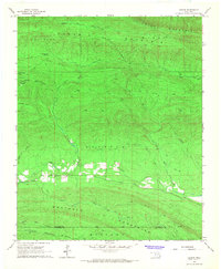
1966 Map of Ludlow
USGS Topo · Published 1967About this map
Kiamichi Mountains and the Boktuklo Mountains dominate this mid-century survey of the rugged borderlands between Le Flore and McCurtain Counties. The settlement of Ludlow sits in a rare clearing along the Little River, serving as a focal point for local history alongside the nearby Ludlow Cemetery. The landscape is a complex of ridges and peaks, including Honobia Mountain, Deadman Mountain, and Wildhorse Mountain, partitioned by the Cowhead Divide and Doe Ridge.
Find a feature on this map
25 named features on this map. Tap any name to fly to it.
Don’t see what you’re looking for? This feature index may not catch every label — zoom into the map to look around manually.
Map Details
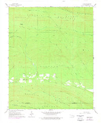
Editions of this 1966 Ludlow Map
2 editions found
Other maps of this area

1900 · Winding Stair
USGS Topo · 1:125,000

1902 · Lukfata
USGS Topo · 1:125,000

1909 · Winding Stair
USGS Topo · 1:125,000

1950 · Mcalester
USGS Topo · 1:250,000

1959 · Page
USGS Topo · 1:62,500

1960 · Bethel
USGS Topo · 1:62,500

1960 · Smithville
USGS Topo · 1:62,500

1962 · McAlester
USGS Topo · 1:250,000

1965 · McAlester
USGS Topo · 1:250,000
1966 · Muse
USGS Topo · 1:24,000