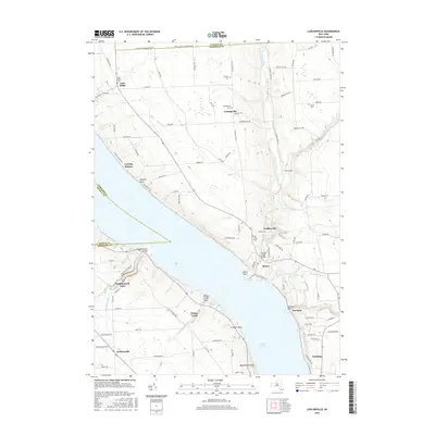
2016 Map of Ludlowville
USGS Topo · Published 2016About this map
Cayuga Lake dominates this 2016 survey, with the steep glaciated slopes of the Finger Lakes region defining the settlement patterns of Tompkins and Seneca Counties. Along the western shore, the dramatic descent of Taughannock Creek leads to the iconic Taughannock Falls, a major natural landmark that has shaped local geography for centuries. Across the water, the eastern shore is characterized by a series of points and landings, including Myers Point and Crowbar Point, which historically served as vital connections for lake-based transport and recreation.
Find a feature on this map
104 named features on this map. Tap any name to fly to it.
Don’t see what you’re looking for? This feature index may not catch every label — zoom into the map to look around manually.
Map Details
Editions of this 2016 Ludlowville Map
This is the sole edition of this map. No revisions or reprints were ever made.
Other maps of this area

1893 · Ithaca
USGS Topo · 1:62,500

1895 · Ithaca
USGS Topo · 1:62,500

1898 · Moravia
USGS Topo · 1:62,500

1900 · Dryden
USGS Topo · 1:62,500

1902 · Moravia
USGS Topo · 1:62,500

1902 · Genoa
USGS Topo · 1:62,500

1905 · Watkins Glen
USGS Topo · 1:125,000

1906 · Catatonk
USGS Topo · 1:125,000

1942 · Ludlowville
USGS Topo · 1:24,000

1942 · Sheldrake
USGS Topo · 1:24,000