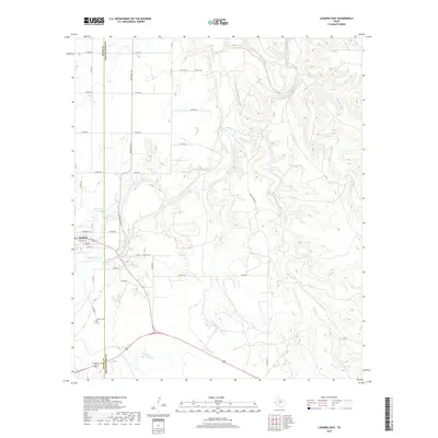
2019 Map of Lueders East
USGS Topo · Published 2019About this map
The town of Lueders straddles the county line between Jones and Shackelford counties, centered around the winding course of the Clear Fork Brazos River. This 2019 survey captures the community’s grid, including street-level detail such as East Main St and East Rhomberg St, along with the Lueders Cemetery located south of the main settlement. The landscape is defined by the convergence of several waterways, including Bluff Creek, Hog Creek, and Chimney Creek, which feed into the river valley. Southwest of the town center lies Lake Penick, a small water body that serves as a focal point for the local geography. The map provides a contemporary view of this rural Texas landscape, showing the distribution of ranch roads and private drives that connect the outlying terrain to the river-based community.
Find a feature on this map
37 named features on this map. Tap any name to fly to it.
Don’t see what you’re looking for? This feature index may not catch every label — zoom into the map to look around manually.
Map Details
Editions of this 2019 Lueders East Map
This is the sole edition of this map. No revisions or reprints were ever made.
Other maps of this area

1891 · Anson
USGS Topo · 1:125,000

1892 · Albany
USGS Topo · 1:125,000

1893 · Albany
USGS Topo · 1:125,000

1893 · Anson
USGS Topo · 1:125,000

1954 · Abilene
USGS Topo · 1:250,000

1957 · Nugent
USGS Topo · 1:62,500

1958 · Abilene
USGS Topo · 1:250,000

1965 · Acampo
USGS Topo · 1:24,000

1965 · Lueders NW
USGS Topo · 1:24,000

1965 · Lueders NE
USGS Topo · 1:24,000