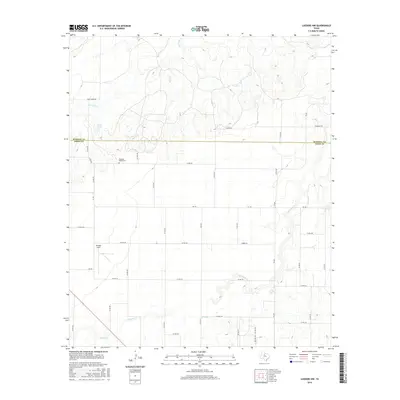
2016 Map of Lueders NW
USGS Topo · Published 2016About this map
The winding course of California Cr defines the southern and eastern landscape of this West Texas region along the Haskell and Jones county line. This agricultural and ranching terrain is marked by a network of rural routes, including FM 600 and Paint Creek Rd, which link scattered local landmarks. Near the western boundary, Arledge Field and the Pleasant Valley Cem serve as key points of reference for local history and genealogy. Water sources are vital to this semi-arid environment, with Flat Paint Cr, Spring Cr, and the small catchment of Bettis Lake providing essential drainage across the rolling plains. The map illustrates a contemporary pattern of land use where section-line roads like Co Rd 210 and Co Rd 245 divide the territory into distinct plots, reflecting the long-standing Texas survey system.
Find a feature on this map
43 named features on this map. Tap any name to fly to it.
Don’t see what you’re looking for? This feature index may not catch every label — zoom into the map to look around manually.
Map Details
Editions of this 2016 Lueders NW Map
This is the sole edition of this map. No revisions or reprints were ever made.
Other maps of this area

1891 · Anson
USGS Topo · 1:125,000

1893 · Anson
USGS Topo · 1:125,000

1954 · Abilene
USGS Topo · 1:250,000

1954 · Wichita Falls
USGS Topo · 1:250,000

1958 · Wichita Falls
USGS Topo · 1:250,000

1958 · Abilene
USGS Topo · 1:250,000

1965 · Lueders NW
USGS Topo · 1:24,000

1965 · Lueders NE
USGS Topo · 1:24,000

1965 · Lueders West
USGS Topo · 1:24,000

1965 · Lueders East
USGS Topo · 1:24,000