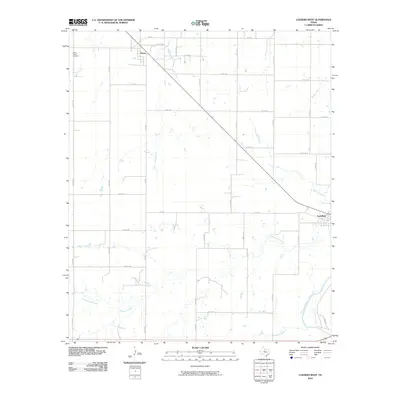
2010 Map of Lueders West
USGS Topo · Published 2010About this map
Avoca and Lueders anchor this section of Jones County, illustrating the agricultural and water-dependent settlement patterns of West Texas. The landscape is defined by the dendritic drainage systems of numerous creeks, most notably Spring Creek, Flag Branch, and Cottonwood Creek, which all contribute to the larger watershed. In the southeast corner, the Clear Fork Brazos River cuts a prominent path, serving as a primary geographic landmark for the region.
Find a feature on this map
42 named features on this map. Tap any name to fly to it.
Don’t see what you’re looking for? This feature index may not catch every label — zoom into the map to look around manually.
Map Details
Editions of this 2010 Lueders West Map
This is the sole edition of this map. No revisions or reprints were ever made.
Other maps of this area

1891 · Anson
USGS Topo · 1:125,000

1893 · Anson
USGS Topo · 1:125,000

1954 · Abilene
USGS Topo · 1:250,000

1957 · Hawley
USGS Topo · 1:62,500

1957 · Nugent
USGS Topo · 1:62,500

1958 · Abilene
USGS Topo · 1:250,000

1965 · Lueders NW
USGS Topo · 1:24,000

1965 · Lueders NE
USGS Topo · 1:24,000

1965 · Lueders West
USGS Topo · 1:24,000

1965 · Lueders East
USGS Topo · 1:24,000