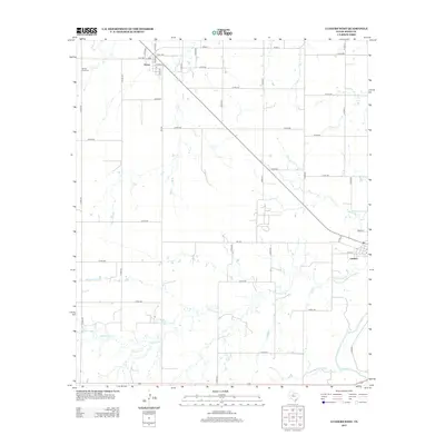
2012 Map of Lueders West
USGS Topo · Published 2012About this map
Avoca and Lueders anchor the agricultural landscape of Jones County in this early 21st-century survey. The terrain is defined by a dense network of seasonal watercourses and drainage basins, including the winding Cottonwood Cr and Mesquite Cr, which eventually lead toward the Clear Fork in the southeastern corner. A legacy of early settlement is visible at Spring Creek Cem in the northwest, situated near the banks of Spring Cr. The map reveals a grid-heavy infrastructure of farm-to-market roads and county routes, such as FM-600 and Avoca Rd, illustrating the modern connectivity of these rural Texas communities while preserving the names of the creeks and branches that have historically dictated the placement of ranching and farming operations.
Find a feature on this map
52 named features on this map. Tap any name to fly to it.
Don’t see what you’re looking for? This feature index may not catch every label — zoom into the map to look around manually.
Map Details
Editions of this 2012 Lueders West Map
This is the sole edition of this map. No revisions or reprints were ever made.
Other maps of this area

1891 · Anson
USGS Topo · 1:125,000

1893 · Anson
USGS Topo · 1:125,000

1954 · Abilene
USGS Topo · 1:250,000

1957 · Hawley
USGS Topo · 1:62,500

1957 · Nugent
USGS Topo · 1:62,500

1958 · Abilene
USGS Topo · 1:250,000

1965 · Lueders NW
USGS Topo · 1:24,000

1965 · Lueders NE
USGS Topo · 1:24,000

1965 · Lueders West
USGS Topo · 1:24,000

1965 · Lueders East
USGS Topo · 1:24,000