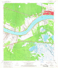
1967 Map of Luling
USGS Topo · Published 1968About this map
The Mississippi River dominates this mid-century landscape, acting as the central artery for a region defined by its industrial and aviation infrastructure. On the north bank, the New Orleans International Airport (Moisant Field) and the Good Hope Oil and Gas Field signal the era's heavy investment in energy and transportation. Residential pockets like Luling, Destrehan, and Mimosa Park are woven between extensive rail lines, including the Illinois Central and Gulf Railroad and the Texas and Pacific Railway.
Find a feature on this map
41 named features on this map. Tap any name to fly to it.
Don’t see what you’re looking for? This feature index may not catch every label — zoom into the map to look around manually.
Map Details
Editions of this 1967 Luling Map
4 editions found
Other maps of this area

1891 · Hahnville
USGS Topo · 1:62,500

1891 · Spanish Fort
USGS Topo · 1:62,500

1891 · New Orleans
USGS Topo · 1:62,500

1892 · Bonnet Carre
USGS Topo · 1:62,500

1932 · New Orleans NW
USGS Topo · 1:31,680

1932 · New Orleans SW
USGS Topo · 1:31,680

1932 · Hahnville NW
USGS Topo · 1:31,680

1932 · Hahnville SW
USGS Topo · 1:31,680

1932 · Hahnville NE
USGS Topo · 1:31,680

1935 · Laplace
USGS Topo · 1:31,680