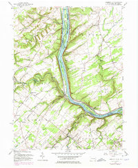
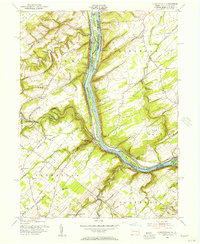
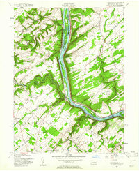
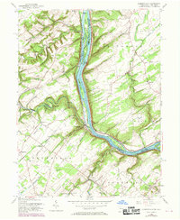
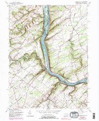
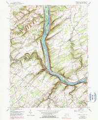
1955 Map of Lumberville
USGS Topo · Published 1974About this map
The Delaware River defines the heart of this landscape, separating the riverfront hamlets of Lumberville and Point Pleasant on the Pennsylvania side from Byram and Raven Rock in New Jersey. During the mid-20th century, the Penn Central rail line traced the eastern bank through Kingwood Station, while the western side was marked by the winding courses of Tohickon Creek and Tinicum Creek. A rural network of schoolhouses and houses of worship served these river communities, including the Brick Church and Groveland School in the west, and the Kingwood Church to the east. Notable landmarks like Doans Cave and the Quarry near Point Pleasant speak to the local geological and cultural history, while the numerous islands—including Treasure Island, Marshall Island, and Walls Island—underscore the river's central role in the regional geography.
Find a feature on this map
73 named features on this map. Tap any name to fly to it.
Don’t see what you’re looking for? This feature index may not catch every label — zoom into the map to look around manually.
Map Details
Editions of this 1955 Lumberville Map
6 editions found
Other maps of this area

1890 · Easton
USGS Topo · 1:62,500

1890 · High Bridge
USGS Topo · 1:62,500

1890 · Lambertville
USGS Topo · 1:62,500

1890 · Doylestown
USGS Topo · 1:62,500

1891 · Easton
USGS Topo · 1:62,500

1891 · Lambertville
USGS Topo · 1:62,500

1891 · Doylestown
USGS Topo · 1:62,500

1894 · Lambertville
USGS Topo · 1:62,500

1898 · High Bridge
USGS Topo · 1:62,500

1900 · Raritan
USGS Topo · 1:125,000
Featured Places
- Buckingham Township, PA
- Solebury Township, PA
- Bedminster Township, PA
- Tinicum Township, PA
- Kingwood Township, NJ