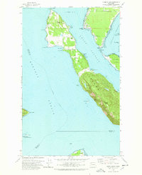
1978 Map of Lummi Island
USGS Topo · Published 1978About this map
Lummi Island and its surrounding archipelago define this maritime landscape in Whatcom County, where the island's interior rises sharply to Lummi Peak and Richards Mtn. In the late 1970s, the northern lowlands and coastal fringes reveal a established network of roads like West Shore Drive and Nugent Road, supporting localized settlements and retreats such as Loganita Lodge, The Willows, and the community of Lummi Island. The map details the delicate coastal geography of the Strait of Georgia and Hale Passage, including the tidal connection known as The Portage leading to Portage Island. Shoreline industry and navigation are visible through features like the Quarry near Smugglers Cove, a Borrow Pit on the mainland, and several lights marking points like Village Point and Lummi Rocks. This coastal survey documents the intersection of recreational space at Lummi Marine Park and the protected environment of the San Juan Islands National Wildlife Refuge.
Find a feature on this map
55 named features on this map. Tap any name to fly to it.
Don’t see what you’re looking for? This feature index may not catch every label — zoom into the map to look around manually.
Map Details
Editions of this 1978 Lummi Island Map
2 editions found
Other maps of this area

1907 · Blaine
USGS Topo · 1:62,500

1943 · Orcas Island
USGS Topo · 1:62,500

1943 · Anacortes
USGS Topo · 1:62,500

1951 · Anacortes
USGS Topo · 1:62,500

1952 · Ferndale
USGS Topo · 1:24,000

1952 · Lummi Bay
USGS Topo · 1:24,000

1952 · Blaine
USGS Topo · 1:62,500

1957 · Orcas Island
USGS Topo · 1:62,500

1957 · Victoria
USGS Topo · 1:250,000

1973 · Cypress Island
USGS Topo · 1:24,000