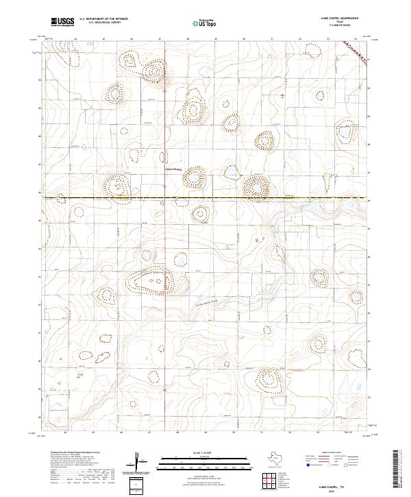
2022 Map of Lums Chapel
USGS Topo · Published 2022About this map
Lums Chapel sits at the heart of this High Plains landscape, situated along the county line between Lamb Co Hockley Co. This agricultural region is defined by a grid-like network of rural routes and the subtle topography of the Llano Estacado. The drainage of Yellow House Draw meanders through the southern portion of the quadrangle, serving as the primary natural landmark in a territory dominated by cotton fields and intermittent playa lakes. The naming conventions of the local roads are particularly striking, featuring an eclectic mix of states, countries, and international locales. Geographers and local historians can trace the paths of Tennessee, Spain, Poland, and Ontario, alongside regional arteries like Fm 597. This 2022 survey captures the persistent rural character of the Texas Panhandle, where the intersection of state-named roads and established farm-to-market routes creates a unique navigational identity.
Find a feature on this map
19 named features on this map. Tap any name to fly to it.
Don’t see what you’re looking for? This feature index may not catch every label — zoom into the map to look around manually.
Map Details
Editions of this 2022 Lums Chapel Map
This is the sole edition of this map. No revisions or reprints were ever made.
Other maps of this area

1954 · Brownfield
USGS Topo · 1:250,000

1957 · Anton
USGS Topo · 1:62,500

1957 · Wolfforth
USGS Topo · 1:62,500

1958 · Brownfield
USGS Topo · 1:250,000

1962 · Brownfield
USGS Topo · 1:250,000

1964 · Oklahoma Flat
USGS Topo · 1:24,000

1964 · Littlefield
USGS Topo · 1:24,000
1964 · Bull Lake
USGS Topo · 1:24,000

1964 · Lums Chapel
USGS Topo · 1:24,000

1964 · Whitharral
USGS Topo · 1:24,000