
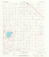
1964 Map of Lums Chapel
USGS Topo · Published 1966About this map
Yellow House Draw meanders through this portion of the Texas Panhandle, carving a distinct topographical path across the agricultural landscape. The 1964 topography reveals a region defined by its energy and transport infrastructure, notably the Anton West Oil Field and various Pumping Sta locations. Small-scale development is centered around Lums Chapel, while the county line between Lamb Co and Hockley Co bisects the survey area. This map captures the industrial character of the South Plains at mid-century, where the Panhandle and Santa Fe railroad line and a network of pipelines support the local petroleum and farming economy. Notable landmarks like the local Water Tank and the path of Route 84 provide anchor points for family historians tracing the physical layout of the plains before modern expansion changed the footprint of these rural communities.
Find a feature on this map
9 named features on this map. Tap any name to fly to it.
Don’t see what you’re looking for? This feature index may not catch every label — zoom into the map to look around manually.
Map Details
Editions of this 1964 Lums Chapel Map
This is the sole edition of this map. No revisions or reprints were ever made.
Other maps of this area

1954 · Brownfield
USGS Topo · 1:250,000

1957 · Anton
USGS Topo · 1:62,500

1957 · Wolfforth
USGS Topo · 1:62,500

1958 · Brownfield
USGS Topo · 1:250,000

1962 · Brownfield
USGS Topo · 1:250,000

1964 · Oklahoma Flat
USGS Topo · 1:24,000

1964 · Littlefield
USGS Topo · 1:24,000
1964 · Bull Lake
USGS Topo · 1:24,000

1964 · Whitharral
USGS Topo · 1:24,000

1965 · Hester Ranch
USGS Topo · 1:24,000