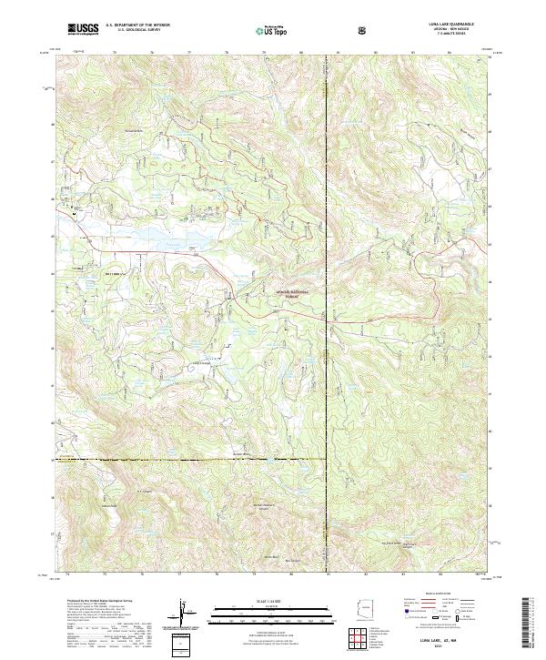
2021 Map of Luna Lake
USGS Topo · Published 2021About this map
Luna Lake and the high-elevation terrain of the Apache National Forest dominate this landscape along the Arizona-New Mexico state line. The map highlights a network of water management features and historical trails, including the Luna Lake Long Loop Trl and Georges Lake Trl, which wind around landmarks like Escudilla Mtn and Cotton Flat. The drainage of the San Francisco River cuts through the center, supported by numerous springs and tanks such as Skousen Spring and Terry Tank.
Find a feature on this map
84 named features on this map. Tap any name to fly to it.
Don’t see what you’re looking for? This feature index may not catch every label — zoom into the map to look around manually.
Map Details
Editions of this 2021 Luna Lake Map
This is the sole edition of this map. No revisions or reprints were ever made.
Other maps of this area

1915 · Reserve
USGS Topo · 1:125,000

1918 · Reserve
USGS Topo · 1:125,000

1922 · Nutrioso
USGS Topo · 1:125,000

1954 · Clifton
USGS Topo · 1:250,000

1957 · Clifton
USGS Topo · 1:250,000

1958 · Clifton
USGS Topo · 1:250,000

1958 · Alpine
USGS Topo · 1:62,500

1961 · Blue
USGS Topo · 1:62,500

1962 · Clifton
USGS Topo · 1:250,000
1965 · Underwood Lake
USGS Topo · 1:24,000